|
search place name
|
||
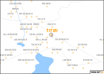
Titiri (La Paz, Bolivia)Titiri is a town in the La Paz region of Bolivia. An overview map of the region around Titiri is displayed below.
regional and 3d topo map of Titiri, Bolivia ::
Titiri airports ::
The nearest airport is LPB - La Paz El Alto Intl, located 95.1 km north west of Titiri.
Other airports nearby include CBB - Cochabamba Jorge Wilsterman (176.5 km east), Nearby towns ::
Marchi (1.8km west) //
Yrucirca (2.6km south west) //
Atuquiri (2.6km north west) //
Romercota (2.6km north west) //
Pusuta (3.7km north) //
Chijmuni (4.1km south west) //
Chijraquita (4.0km south east) //
Calacoto (4.0km north east) //
Arillanga (4.0km south west) //
Taipillanga (5.3km west) //
Chilligua (5.6km south) //
Piquimani (5.8km south) //
Tolacica (6.5km south west) //
Osari (6.5km north west) //
Chijta (6.6km north west) //
Puti (7.7km south west) //
Culta (8.0km north west) //
Vila Vila (9.0km south east) //
Carajarani (9.1km north west) //
Huacachinuña (9.0km south west) //
Machacamarca (10.3km north west) //
[all distances 'as the bird flies' and approximate]  Places with similar names to Titiri, Bolivia ::
Disclaimer :: Information on this page comes without warranty of any kind |
||
|
Where is Titiri? Elevation and coordinates ::
Latitude (lat): 17°18'0"S Longitude (lon): 67°50'0"W
Elevation (approx.): 3832m (map arrows pan, magnifying glasses zoom) |
||
|
Visiting Titiri? Hotel/Accommodation ::
Book a hotel in Titiri Travel Guide ::
Buy a travel guide for Bolivia rental cars ::
car rental offers GPS waypoint ::
download a GPX waypoint (PoI) of Titiri for your GPS receiver
|
||