|
search place name
|
||
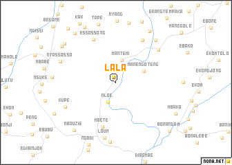
Lala (Littoral, Cameroon)Lala is a town in the Littoral region of Cameroon. An overview map of the region around Lala is displayed below.
regional and 3d topo map of Lala, Cameroon ::
Lala airports ::
The nearest airport is DLA - Douala, located 87.6 km south of Lala.
Other airports nearby include TKC - Tiko (90.1 km south west), BFX - Bafoussam (104.9 km north east), BPC - Bamenda (143.0 km north), FOM - Foumban Nkounja (143.6 km north east), Nearby towns ::
Kola (2.1km north) //
Nloé (3.4km south) //
Mantem I (3.7km north) //
Manengoteng (4.9km east) //
Mbétè (7.5km south) //
Essossong (7.9km north west) //
Loumsi (8.1km north east) //
Manjo (8.7km north east) //
Kupe (9.1km south west) //
Namba (9.4km north east) //
Mantem II (9.9km north east) //
Mbouzie (10.3km south west) //
Mpako (10.4km north west) //
Mundum (10.4km north west) //
Nduma (10.6km north west) //
Bonandam (11.6km south east) //
Nlog (11.8km north west) //
[all distances 'as the bird flies' and approximate] 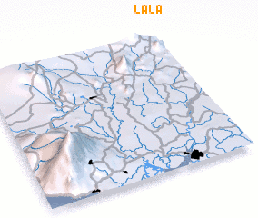 Places with similar names to Lala, Cameroon ::
Disclaimer :: Information on this page comes without warranty of any kind |
||
|
Where is Lala? Elevation and coordinates ::
Latitude (lat): 4°47'50"N Longitude (lon): 9°45'45"E
Elevation (approx.): 392m (map arrows pan, magnifying glasses zoom) |
||
|
Visiting Lala? Hotel/Accommodation ::
Book a hotel in Lala Travel Guide ::
Buy a travel guide for Cameroon rental cars ::
car rental offers GPS waypoint ::
download a GPX waypoint (PoI) of Lala for your GPS receiver
|
||