|
search place name
|
||
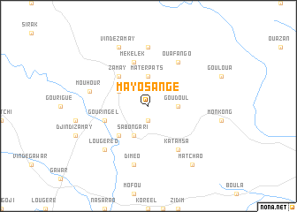
Mayo Sangé (Cameroon)Mayo Sangé is a town in Cameroon. An overview map of the region around Mayo Sangé is displayed below.
regional and 3d topo map of Mayo Sangé, Cameroon ::
Mayo Sangé airports ::
The nearest airport is MVR - Maroua Salak, located 39.1 km south east of Mayo Sangé.
Other airports nearby include GOU - Garoua (152.9 km south west), MIU - Maiduguri (167.2 km north west), NDJ - N'djamena Ndjamena Hassan Djamous (207.9 km north east), YOL - Yola (221.8 km south west), Nearby towns ::
Mouldal (1.9km south) //
Materpats (3.7km north) //
Goudoul (3.6km east) //
Sabongari (4.1km south west) //
Pomla (4.1km north west) //
Ouro Mansout (5.2km south west) //
Zamay (5.2km north west) //
Mékélek (5.9km north) //
Gouringel (5.8km west) //
Minawao (5.8km west) //
Katamsa (6.6km south east) //
Ouafango (6.6km north east) //
Tchouvouk (7.4km north) //
Mouhour (7.5km west) //
Diméo (7.6km south) //
Ferndé (7.8km south west) //
Lougéréo (7.8km south west) //
Vindé Zamay (8.3km north west) //
Matchao (9.2km south east) //
[all distances 'as the bird flies' and approximate] 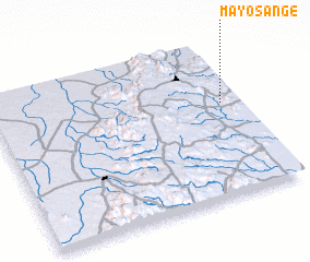 Places with similar names to Mayo Sangé, Cameroon :: Disclaimer :: Information on this page comes without warranty of any kind |
||
|
Where is Mayo Sangé? Elevation and coordinates ::
Latitude (lat): 10°36'0"N Longitude (lon): 13°56'0"E
Elevation (approx.): 654m (map arrows pan, magnifying glasses zoom) |
||
|
Visiting Mayo Sangé? Hotel/Accommodation ::
Book a hotel in Mayo Sangé Travel Guide ::
Buy a travel guide for Cameroon rental cars ::
car rental offers GPS waypoint ::
download a GPX waypoint (PoI) of Mayo Sangé for your GPS receiver
|
||