|
search place name
|
||
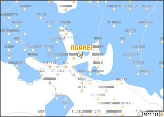
Ngamé I (Cameroon)Ngamé I is a town in Cameroon. An overview map of the region around Ngamé I is displayed below.
regional and 3d topo map of Ngamé I, Cameroon ::
Ngamé I airports ::
The nearest airport is NDJ - N'djamena Ndjamena Hassan Djamous, located 34.5 km east of Ngamé I.
Other airports nearby include MIU - Maiduguri (184.7 km west), MVR - Maroua Salak (203.8 km south), Nearby towns ::
Midan (1.8km west) //
Flétari (1.9km north) //
Ngamé II (2.6km south west) //
Somou (3.7km south) //
Séhéba (3.6km east) //
Mour (4.1km south west) //
Sou (4.1km south west) //
Blo (4.1km south west) //
Sou (4.1km south west) //
Ouda (4.1km south east) //
Naala (4.1km south east) //
Souéba (4.1km north east) //
Ousada (5.2km south east) //
Baké (5.2km north east) //
Gada (5.6km south) //
Ngardoukoum (5.4km west) //
Gouloumbo (5.7km west) //
Doubabé Ras el Fîl (5.8km south) //
Galégalé (6.6km south west) //
Amkindin (6.6km north west) //
Gounféla (6.6km north west) //
Béla (7.4km south) //
Matkous (7.5km west) //
Amfey (7.5km west) //
Gourié (8.3km north west) //
Mabrouka (9.2km south east) //
Maniago (9.1km south west) //
Doubabé Gos (9.2km south east) //
Damba (10.4km north west) //
[all distances 'as the bird flies' and approximate] 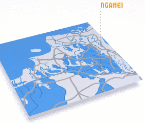 Places with similar names to Ngamé I, Cameroon ::
Disclaimer :: Information on this page comes without warranty of any kind |
||
|
Where is Ngamé I? Elevation and coordinates ::
Latitude (lat): 12°14'0"N Longitude (lon): 14°44'0"E
Elevation (approx.): 294m (map arrows pan, magnifying glasses zoom) |
||
|
Visiting Ngamé I? Hotel/Accommodation ::
Book a hotel in Ngamé I Travel Guide ::
Buy a travel guide for Cameroon rental cars ::
car rental offers GPS waypoint ::
download a GPX waypoint (PoI) of Ngamé I for your GPS receiver
|
||