|
search place name
|
||
Phumĭ Sângkaeub (1) (Kâmpóng Cham, Cambodia)Phumĭ Sângkaeub (1) is a town in the Kâmpóng Cham region of Cambodia. An overview map of the region around Phumĭ Sângkaeub (1) is displayed below.
regional and 3d topo map of Phumĭ Sângkaeub (1), Cambodia ::

Phumĭ Sângkaeub (1) airports ::
The nearest airport is PNH - Phnom-penh Phnom Penh Intl, located 37.7 km south of Phumĭ Sângkaeub (1).
Other airports nearby include REP - Siem-reap Siem Reap (206.1 km north west), SGN - Ho Chi Minh City Tansonnhat Intl (224.6 km south east), Nearby towns ::
Phumĭ Ta Pôy (1.8km east) //
Phumĭ Sângkaeub (2) (1.8km west) //
Phumĭ Cheung Tœ̆k (3.6km east) //
Phumĭ Prasat (4.1km south east) //
Phumĭ Phnum Thum (4.1km north east) //
Phumĭ Âk Tiĕng (5.2km south east) //
Phumĭ Chéaléa (5.2km north east) //
Khŭm Tăng Krăng (5.4km east) //
Phumĭ Sâmbo (5.7km west) //
Phumĭ Kâmpóng Preăh (7.5km east) //
Phumĭ Kâmpóng Prasat (8.1km south east) //
Khŭm Svay Âmpéa (9.2km south east) //
Phumĭ Khla Krôhœ̆m Kaeut (9.1km north west) //
Phumĭ Chântôr (9.1km north west) //
Phumĭ Chăn Phloŭs (9.1km south east) //
[all distances 'as the bird flies' and approximate] 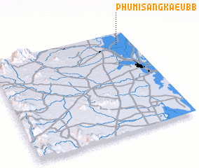 Places with similar names to Phumĭ Sângkaeub (1), Cambodia ::
// Phumĭ Sângkĕb (KH)
Disclaimer :: Information on this page comes without warranty of any kind |
||
|
Where is Phumĭ Sângkaeub (1)? Elevation and coordinates ::
Latitude (lat): 11°53'0"N Longitude (lon): 104°54'0"E
Elevation (approx.): 9m (map arrows pan, magnifying glasses zoom) |
||
|
Visiting Phumĭ Sângkaeub (1)? Hotel/Accommodation ::
Book a hotel in Phumĭ Sângkaeub (1) Travel Guide ::
Buy a travel guide for Cambodia rental cars ::
car rental offers GPS waypoint ::
download a GPX waypoint (PoI) of Phumĭ Sângkaeub (1) for your GPS receiver
|
||