|
search place name
|
||
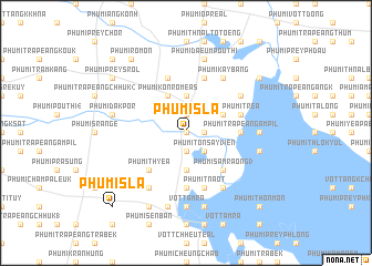
Phumĭ Sla (Takêv, Cambodia)Phumĭ Sla is a town in the Takêv region of Cambodia. An overview map of the region around Phumĭ Sla is displayed below.
regional and 3d topo map of Phumĭ Sla, Cambodia ::
Phumĭ Sla airports ::
The nearest airport is PNH - Phnom-penh Phnom Penh Intl, located 53.8 km north of Phumĭ Sla.
Other airports nearby include SGN - Ho Chi Minh City Tansonnhat Intl (207.9 km east), Nearby towns ::
Phumĭ Svay Prey (0.0km north) //
Phumĭ Lumcháng (0.0km north) //
Phumĭ Kdŏl (1.8km east) //
Phumĭ Trâpeăng Vêng (2) (1.9km north) //
Phumĭ Ta Mung (2) (1.9km south) //
Phumĭ Ta Meăh (1.9km south) //
Phumĭ Tônsay Viĕn (2.6km south east) //
Phumĭ Chhuk Sâr (3.7km north) //
Phumĭ Prey Prŭm (1) (3.7km south) //
Phumĭ Ângk Kroch (3.7km south) //
Phumĭ Tônloăb (4.1km north east) //
Phumĭ Kon Rõméas (4.1km north west) //
Phumĭ Bœ̆ng Trănh (4.1km north west) //
Phumĭ Sâmrâong (3) (5.2km south east) //
Phumĭ Ângk Tachăn (5.2km south west) //
Phumĭ Thyéa (5.2km south west) //
Phumĭ Trâpeăng Âmpĭl (5.5km east) //
Phumĭ Snaô (5.6km south) //
Phumĭ Tréa (5.8km east) //
Phumĭ Ângk Kdei (5.8km north) //
Phumĭ Tnaôt (5.8km south) //
Phumĭ Péch Ãntréa (5.8km north) //
Phumĭ Kay Băng (6.6km north east) //
Phumĭ Ânhchanh (6.6km north east) //
Phumĭ Krăng Sdau (6.6km north east) //
Phumĭ Kâmpóng Barayn (6.6km south east) //
Phumĭ Svay Rœssei (6.6km south east) //
Phumĭ Ângk Néaréay (6.6km south west) //
Phumĭ Dong (7.3km east) //
[all distances 'as the bird flies' and approximate]  Places with similar names to Phumĭ Sla, Cambodia ::
// Fiumicello (IT)
// Hvamsal (NO)
// Famosla (US)
// Phumĭ O Sala (KH)
// Phumĭ Sala (KH)
// Phumĭ Sala (KH)
// Phumĭ Sala (KH)
// Phumĭ Sala (KH)
// Phumĭ Sala (KH)
// Phumĭ Sĕla (KH)
Disclaimer :: Information on this page comes without warranty of any kind |
||
|
Where is Phumĭ Sla? Elevation and coordinates ::
Latitude (lat): 11°4'0"N Longitude (lon): 104°46'0"E
Elevation (approx.): 10m (map arrows pan, magnifying glasses zoom) |
||
|
Visiting Phumĭ Sla? Hotel/Accommodation ::
Book a hotel in Phumĭ Sla Travel Guide ::
Buy a travel guide for Cambodia rental cars ::
car rental offers GPS waypoint ::
download a GPX waypoint (PoI) of Phumĭ Sla for your GPS receiver
|
||