|
search place name
|
||
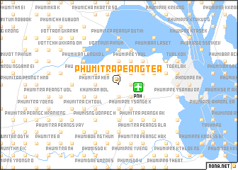
Phumĭ Trâpeăng Téa (Bântéay Méan Cheăy, Cambodia)Phumĭ Trâpeăng Téa is a town in the Bântéay Méan Cheăy region of Cambodia. An overview map of the region around Phumĭ Trâpeăng Téa is displayed below.
regional and 3d topo map of Phumĭ Trâpeăng Téa, Cambodia ::
Phumĭ Trâpeăng Téa airports ::
The nearest airport is PNH - Phnom-penh Phnom Penh Intl, located 3.0 km east of Phumĭ Trâpeăng Téa.
Other airports nearby include SGN - Ho Chi Minh City Tansonnhat Intl (216.1 km east), REP - Siem-reap Siem Reap (233.0 km north west), Nearby towns ::
Phumĭ Trâpeăng Chrey (1.8km east) //
Phumĭ Trâpeăng Thnóng (1.9km north) //
Phumĭ Chângrŭk (1.9km south) //
Khŭm Krăng Thnóng (2.6km north east) //
Phumĭ Chrey Kaông (2.6km south east) //
Phumĭ Sâmraông Téav (2.6km north east) //
Phumĭ Prey Pring (2.6km south east) //
Phumĭ Prey Trach (2.6km south east) //
Khŭm Kakab (2.6km north east) //
Phumĭ Trâpeăng Leuk (2.6km north west) //
Phumĭ Prey Snuŏl (3.6km east) //
Khŭm Koŭk Rôka (3.7km north) //
Phumĭ Krăng Dontey (3.7km south) //
Phumĭ Ta Phém (3.6km west) //
Phumĭ Prey Tráb (3.6km west) //
Phumĭ Prey Mul (4.1km north east) //
Phumĭ Krăng Ântróng (4.1km north east) //
Phumĭ Prey Sândêk (4.1km south east) //
Poŭthĭchĕntŏng (4.1km north east) //
Khŭm Chaômchau (4.1km south east) //
Phumĭ Phlăng (4.1km north west) //
Khŭm Kâmbol (4.1km south west) //
Phumĭ Pôngrô (4.1km north west) //
Phumĭ Chrés (5.2km north east) //
Phumĭ Prey Bœ̆ng (5.2km south west) //
Khŭm Kântoŭk (5.2km south west) //
Phumĭ Khmêr Leu (5.6km north) //
Phumĭ Pŭtréa (5.6km north) //
Phumĭ Prey Kâmbŏt (5.6km south) //
[all distances 'as the bird flies' and approximate]  Places with similar names to Phumĭ Trâpeăng Téa, Cambodia ::
// Phumĭ Trâpeăng Da (KH)
// Phumĭ Trâpeăng Ta Ŭy (KH)
Disclaimer :: Information on this page comes without warranty of any kind |
||
|
Where is Phumĭ Trâpeăng Téa? Elevation and coordinates ::
Latitude (lat): 11°33'0"N Longitude (lon): 104°49'0"E
Elevation (approx.): 16m (map arrows pan, magnifying glasses zoom) |
||
|
Visiting Phumĭ Trâpeăng Téa? Hotel/Accommodation ::
Book a hotel in Phumĭ Trâpeăng Téa Travel Guide ::
Buy a travel guide for Cambodia rental cars ::
car rental offers GPS waypoint ::
download a GPX waypoint (PoI) of Phumĭ Trâpeăng Téa for your GPS receiver
|
||