|
search place name
|
||
Chatantar (Barisāl, Bangladesh)Chatantar is a town in the Barisāl region of Bangladesh. An overview map of the region around Chatantar is displayed below.
regional and 3d topo map of Chatantar, Bangladesh ::

Chatantar airports ::
The nearest airport is DAC - Dhaka Zia Intl, located 76.6 km north west of Chatantar.
Other airports nearby include IXA - Agartala (84.6 km north east), CGP - Chittagong Shah Amanat Intl (153.2 km south east), JSR - Jessore (166.2 km west), IXH - Kailashahar (171.2 km north east), Nearby towns ::
Bākila (0.0km north) //
Sanna (0.0km north) //
Gogra (0.0km north) //
Uchanga (0.5km north west) //
Debpur (1.7km west) //
Dāsergaon (1.7km west) //
Char Bākila (1.7km west) //
Maheshpur (1.9km south) //
Kāmrānga (1.9km south) //
Sātbāria (1.7km east) //
Betiāpāra (1.7km east) //
Rāmpur (2.5km south west) //
South Srīpur (2.5km north west) //
Chhota Sundar (2.5km south west) //
Pānchbāria (2.5km south west) //
Kotrābanda (2.5km north west) //
Bara Sundar (2.5km south west) //
Borkhāl (2.5km north east) //
Manihar (2.5km south east) //
Ālipur (2.5km south east) //
Kordi (2.5km north east) //
Phulcha (2.5km north east) //
Sidla (2.5km north east) //
Tāharkhil (3.4km west) //
Bimalergaon (3.4km west) //
Lodhergaon (3.4km west) //
North Rājāpur (3.7km south) //
Rādhāsār (3.7km north) //
Chhaychila (3.7km north) //
[all distances 'as the bird flies' and approximate] 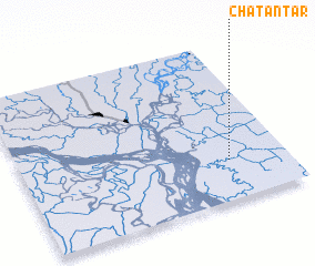 Places with similar names to Chatantar, Bangladesh :: Disclaimer :: Information on this page comes without warranty of any kind |
||
|
Where is Chatantar? Elevation and coordinates ::
Latitude (lat): 23°15'0"N Longitude (lon): 90°47'0"E
Elevation (approx.): 11m (map arrows pan, magnifying glasses zoom) |
||
|
Visiting Chatantar? Hotel/Accommodation ::
Book a hotel in Chatantar Travel Guide ::
Buy a travel guide for Bangladesh rental cars ::
car rental offers GPS waypoint ::
download a GPX waypoint (PoI) of Chatantar for your GPS receiver
|
||