|
search place name
|
||
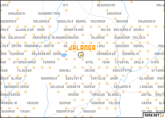
Jalanga (Barisāl, Bangladesh)Jalanga is a town in the Barisāl region of Bangladesh. An overview map of the region around Jalanga is displayed below.
regional and 3d topo map of Jalanga, Bangladesh ::
Jalanga airports ::
The nearest airport is RJH - Rajshahi Shah Mokhdum, located 74.7 km south west of Jalanga.
Other airports nearby include IRD - Ishurdi (86.8 km south), SPD - Saidpur (93.9 km north), COH - Cooch-behar Cooch Behar (158.7 km north), DAC - Dhaka Zia Intl (177.4 km south east), Nearby towns ::
Jiānagar (0.0km north) //
Chhota Nilāhāli (1.9km south) //
Jārai (1.9km south) //
Herenja (1.9km north) //
Bāra Dīghi (1.9km north) //
Bisha (1.9km north) //
Barahi (1.7km west) //
Berāgaon (2.5km south east) //
Saram (2.5km south east) //
Ātal (2.5km south east) //
Jhināi (2.5km south west) //
Polla (2.5km south west) //
Bāgpāl (2.5km south west) //
Khalishwar (2.5km south west) //
Lakshmīmandap (2.5km north east) //
Murtazāpur (2.5km north west) //
Pukurgāchha (3.7km south) //
Pālkuri (3.7km south) //
Belhatta (3.7km south) //
Kāmāru (3.7km south) //
Chāmrul (3.4km east) //
Māhmūdpur (3.4km east) //
Dublāpāra (3.4km east) //
Diyal (3.4km west) //
Belgharia (3.4km west) //
Dulali (3.4km west) //
Shankarbāg (3.7km north) //
Tāloch (4.1km south east) //
Pānchsa (4.1km south east) //
[all distances 'as the bird flies' and approximate]  Places with similar names to Jalanga, Bangladesh ::
Disclaimer :: Information on this page comes without warranty of any kind |
||
|
Where is Jalanga? Elevation and coordinates ::
Latitude (lat): 24°56'0"N Longitude (lon): 89°7'0"E
Elevation (approx.): 19m (map arrows pan, magnifying glasses zoom) |
||
|
Visiting Jalanga? Hotel/Accommodation ::
Book a hotel in Jalanga Travel Guide ::
Buy a travel guide for Bangladesh rental cars ::
car rental offers GPS waypoint ::
download a GPX waypoint (PoI) of Jalanga for your GPS receiver
|
||