|
search place name
|
||
Jāmhāta (Barisāl, Bangladesh)Jāmhāta is a town in the Barisāl region of Bangladesh. An overview map of the region around Jāmhāta is displayed below.
regional and 3d topo map of Jāmhāta, Bangladesh ::

Jāmhāta airports ::
The nearest airport is IRD - Ishurdi, located 73.2 km south of Jāmhāta.
Other airports nearby include RJH - Rajshahi Shah Mokhdum (79.7 km south west), SPD - Saidpur (117.4 km north), DAC - Dhaka Zia Intl (150.0 km south east), COH - Cooch-behar Cooch Behar (173.9 km north), Nearby towns ::
Kalmāshiba (NaNkm north) //
Sheikh Kalma (NaNkm north) //
Deshma (NaNkm north) //
Bara Chāpar (1.9km north) //
Bisha (1.9km north) //
Jagannāthpur (1.7km east) //
Shāntiāra (1.9km south) //
Kariānjal (1.9km south) //
Bhādāikāndi (1.9km south) //
Chandrahāta (1.9km south) //
Sabrul (2.5km north east) //
Bara Gācha (2.5km north west) //
Mātihās (2.5km north west) //
Āgmājhi (2.5km south east) //
Titkhur (2.5km south east) //
Banbhita (2.5km south east) //
Birgaon (3.4km east) //
Chandibor (3.4km east) //
Raghunāthpur (3.7km north) //
Arul (3.7km north) //
Dehar (3.7km north) //
Khandakshetra (3.7km south) //
Pānisāra (3.4km west) //
Kalyānpāra (3.4km west) //
Ālagchhatra (3.4km west) //
Chak Bhali (3.8km north east) //
Bānsbāria (3.8km south east) //
Dumargaon (4.1km north west) //
Sātrukha (3.8km north west) //
[all distances 'as the bird flies' and approximate] 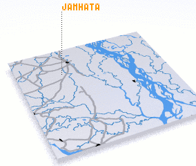 Places with similar names to Jāmhāta, Bangladesh ::
// Jamhat (PK)
Disclaimer :: Information on this page comes without warranty of any kind |
||
|
Where is Jāmhāta? Elevation and coordinates ::
Latitude (lat): 24°46'0"N Longitude (lon): 89°19'0"E
Elevation (approx.): 16m (map arrows pan, magnifying glasses zoom) |
||
|
Visiting Jāmhāta? Hotel/Accommodation ::
Book a hotel in Jāmhāta Travel Guide ::
Buy a travel guide for Bangladesh rental cars ::
car rental offers GPS waypoint ::
download a GPX waypoint (PoI) of Jāmhāta for your GPS receiver
|
||