|
search place name
|
||
Jhalmala (Barisāl, Bangladesh)Jhalmala is a town in the Barisāl region of Bangladesh. An overview map of the region around Jhalmala is displayed below.
regional and 3d topo map of Jhalmala, Bangladesh ::

Jhalmala airports ::
The nearest airport is DAC - Dhaka Zia Intl, located 106.3 km south of Jhalmala.
Other airports nearby include IXA - Agartala (112.7 km south east), ZYL - Sylhet Osmani Osmany Intl (121.6 km east), IXH - Kailashahar (143.4 km east), IRD - Ishurdi (179.1 km west), Nearby towns ::
Karmaria (NaNkm north) //
Bishampur (1.9km north) //
Māoha (1.9km north) //
Bārha (1.9km north) //
Singchāpur (1.9km north) //
Kumri (1.7km west) //
Sahar Āhāmmadpur (1.7km west) //
Bhutiārkona (1.7km west) //
Dhārākāndi (1.7km west) //
Kella Tājpur (1.7km west) //
Bir Ahmadpur (1.9km south) //
Ghāturkona (1.9km south) //
Sonāmpur (1.9km south) //
Bhuiāpāra (1.7km east) //
Dherua Kareha (1.7km east) //
Swalpa Naohāta (1.7km east) //
Bri Naohāta (1.7km east) //
Paluhāti (2.5km north west) //
Khaladbāri (2.5km north west) //
Pājuhāti (2.5km north east) //
Tantirpayār (2.5km south west) //
Lanka Khola (2.5km south west) //
Lāturpayār (2.5km south west) //
Lanka Kāndi (2.5km south west) //
Gidhāusha (2.5km south east) //
Pānch Kāhania (3.4km west) //
Bil Heluchia (3.7km north) //
Rāi Simul (3.7km south) //
Pāchhār (3.7km south) //
[all distances 'as the bird flies' and approximate] 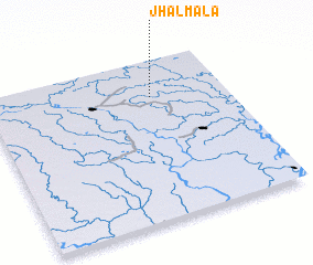 Places with similar names to Jhalmala, Bangladesh ::
Disclaimer :: Information on this page comes without warranty of any kind |
||
|
Where is Jhalmala? Elevation and coordinates ::
Latitude (lat): 24°46'0"N Longitude (lon): 90°41'0"E
Elevation (approx.): 13m (map arrows pan, magnifying glasses zoom) |
||
|
Visiting Jhalmala? Hotel/Accommodation ::
Book a hotel in Jhalmala Travel Guide ::
Buy a travel guide for Bangladesh rental cars ::
car rental offers GPS waypoint ::
download a GPX waypoint (PoI) of Jhalmala for your GPS receiver
|
||