|
search place name
|
||
Kānāinagar (Barisāl, Bangladesh)Kānāinagar is a town in the Barisāl region of Bangladesh. An overview map of the region around Kānāinagar is displayed below.
regional and 3d topo map of Kānāinagar, Bangladesh ::

Kānāinagar airports ::
The nearest airport is JSR - Jessore, located 15.8 km east of Kānāinagar.
Other airports nearby include CCU - Calcutta Netaji Subhash Chandra Bose Intl (78.9 km south west), IRD - Ishurdi (112.9 km north), RJH - Rajshahi Shah Mokhdum (150.1 km north), DAC - Dhaka Zia Intl (161.5 km north east), Nearby towns ::
Rādhānagar (0.0km north) //
Krishnachandrapur (0.0km north) //
Nabagrām (1.7km east) //
Gangādharpur (1.7km east) //
Kāgmāri (1.9km north) //
Kandarpapur (1.7km west) //
Uttar Rājāpur (2.5km south east) //
Ājampur (2.5km south east) //
Jiuligāchha (2.5km north east) //
Dosatina (3.4km east) //
Pālla (3.4km east) //
Khāskhāli (3.7km south) //
Sāgarpur (3.7km south) //
Srirāmkāti (3.7km south) //
Bālia (3.7km north) //
Bishahari (3.7km north) //
Simulia Gopināthpur (4.1km south east) //
Madhukhāli (3.9km south east) //
Bodhkhāna (3.9km south east) //
Jamālpur (3.9km north east) //
Kerālkhāli (4.1km south west) //
Chhutipur (4.1km north east) //
Gangānandapur (4.1km north east) //
Panditpur (4.1km north west) //
Gaursuti (4.1km north west) //
Gokarna (3.9km north west) //
Fatehpur (5.0km south east) //
Jāfarnagar (5.0km south east) //
Kāmārpāra (5.0km south east) //
[all distances 'as the bird flies' and approximate] 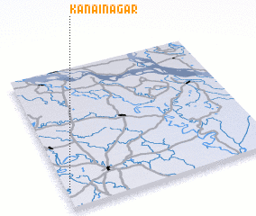 Places with similar names to Kānāinagar, Bangladesh ::
// Kānāinagar (BD)
// Kānāinagar (BD)
// Kānāinagar (BD)
// Kānāinagar (BD)
// Kānāinagar (BD)
// Kānāinagar (BD)
// Konankira (BF)
// Caño Negro (CO)
// Caño Negro (CR)
// Caño Negro (CR)
Disclaimer :: Information on this page comes without warranty of any kind |
||
|
Where is Kānāinagar? Elevation and coordinates ::
Latitude (lat): 23°8'0"N Longitude (lon): 89°1'0"E
Elevation (approx.): 10m (map arrows pan, magnifying glasses zoom) |
||
|
Visiting Kānāinagar? Hotel/Accommodation ::
Book a hotel in Kānāinagar Travel Guide ::
Buy a travel guide for Bangladesh rental cars ::
car rental offers GPS waypoint ::
download a GPX waypoint (PoI) of Kānāinagar for your GPS receiver
|
||