|
search place name
|
||
Kodālia (Barisāl, Bangladesh)Kodālia is a town in the Barisāl region of Bangladesh. An overview map of the region around Kodālia is displayed below.
regional and 3d topo map of Kodālia, Bangladesh ::

Kodālia airports ::
The nearest airport is DAC - Dhaka Zia Intl, located 54.6 km east of Kodālia.
Other airports nearby include IRD - Ishurdi (86.8 km west), JSR - Jessore (115.2 km south west), RJH - Rajshahi Shah Mokhdum (138.2 km west), IXA - Agartala (138.6 km east), Nearby towns ::
Seharāil (0.0km north) //
Singdāir (0.0km north) //
Ātia Ulāin (1.9km south) //
Tāluk Hāpānia (1.9km south) //
Paschim Tegharia (1.9km south) //
Ichhāil Gāzi (1.9km south) //
Dhalthopa (1.7km west) //
Jālālia (1.7km west) //
Behāli Khāmār (1.7km west) //
Ārra Kumed (1.7km west) //
Lakshmidia (1.9km north) //
Kāsināra (1.9km north) //
Hāpānia (1.7km east) //
Patal (1.7km east) //
Beta (1.7km east) //
Tepri (2.5km south west) //
Bāde Behāli (2.5km south west) //
Silimpur (2.5km south east) //
Āhulia (2.5km south east) //
Āg Kalia (2.5km south east) //
Uāil (2.5km south east) //
Bil Kālidaha (2.5km south east) //
Pāchh Kalia (2.5km south east) //
Bādiājān (2.5km north east) //
Kāonhala (2.5km north east) //
Barigrām (2.5km north east) //
Rāmbāti (3.7km south) //
Baora (3.7km south) //
Juginda (3.7km south) //
[all distances 'as the bird flies' and approximate] 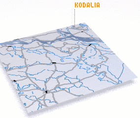 Places with similar names to Kodālia, Bangladesh ::
Disclaimer :: Information on this page comes without warranty of any kind |
||
|
Where is Kodālia? Elevation and coordinates ::
Latitude (lat): 23°59'0"N Longitude (lon): 89°53'0"E
Elevation (approx.): 10m (map arrows pan, magnifying glasses zoom) |
||
|
Visiting Kodālia? Hotel/Accommodation ::
Book a hotel in Kodālia Travel Guide ::
Buy a travel guide for Bangladesh rental cars ::
car rental offers GPS waypoint ::
download a GPX waypoint (PoI) of Kodālia for your GPS receiver
|
||