|
search place name
|
||
Purba Gopālpur (Barisāl, Bangladesh)Purba Gopālpur is a town in the Barisāl region of Bangladesh. An overview map of the region around Purba Gopālpur is displayed below.
regional and 3d topo map of Purba Gopālpur, Bangladesh ::

Purba Gopālpur airports ::
The nearest airport is DAC - Dhaka Zia Intl, located 13.7 km east of Purba Gopālpur.
Other airports nearby include IXA - Agartala (99.5 km east), IRD - Ishurdi (129.3 km west), JSR - Jessore (132.9 km south west), RJH - Rajshahi Shah Mokhdum (181.3 km north west), Nearby towns ::
Gerdda (0.0km north) //
Fulbāri (0.0km north) //
Genda (0.0km north) //
Dakshin Rāmchandrapur (0.0km north) //
Baruigrām (0.0km north) //
Sādhāpur (1.7km east) //
Gāndhāria (1.7km east) //
Bil Bāghil (1.7km east) //
Rājiber Tek (1.9km north) //
Bara Balimehār (1.9km north) //
Sankarpur (1.9km north) //
Imāmaddipur (1.9km north) //
Sarkarbāri (1.9km north) //
Tiabāri (1.9km north) //
Dakshin Rāmnagar (1.9km north) //
Jāmur Muchipāra (1.9km south) //
Jāmur Khidragati (1.9km south) //
Tetuljhora (1.9km south) //
Kulāsur (1.9km south) //
Khidragati (1.9km south) //
Rājāghāt (1.9km south) //
Sobhāpur (1.9km south) //
Pānpāra (1.7km west) //
Dakshin Dattapāra (1.7km west) //
Bārha (1.7km west) //
Bardhanpāra (1.7km west) //
Nātarpāra (1.7km west) //
Goālbāri (1.7km west) //
Bāijuri (1.7km west) //
[all distances 'as the bird flies' and approximate] 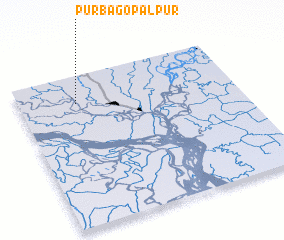 Places with similar names to Purba Gopālpur, Bangladesh ::
// Purba Gopālpur (BD)
Disclaimer :: Information on this page comes without warranty of any kind |
||
|
Where is Purba Gopālpur? Elevation and coordinates ::
Latitude (lat): 23°49'0"N Longitude (lon): 90°16'0"E
Elevation (approx.): 9m (map arrows pan, magnifying glasses zoom) |
||
|
Visiting Purba Gopālpur? Hotel/Accommodation ::
Book a hotel in Purba Gopālpur Travel Guide ::
Buy a travel guide for Bangladesh rental cars ::
car rental offers GPS waypoint ::
download a GPX waypoint (PoI) of Purba Gopālpur for your GPS receiver
|
||