|
search place name
|
||
Sāmukkhola (Barisāl, Bangladesh)Sāmukkhola is a town in the Barisāl region of Bangladesh. An overview map of the region around Sāmukkhola is displayed below.
regional and 3d topo map of Sāmukkhola, Bangladesh ::

Sāmukkhola airports ::
The nearest airport is JSR - Jessore, located 47.2 km west of Sāmukkhola.
Other airports nearby include DAC - Dhaka Zia Intl (103.3 km north east), IRD - Ishurdi (115.5 km north west), CCU - Calcutta Netaji Subhash Chandra Bose Intl (136.9 km south west), RJH - Rajshahi Shah Mokhdum (166.3 km north west), Nearby towns ::
Noāgrām (0.0km north) //
Kāonsisa (0.0km north) //
Raghunāthpur (1.9km north) //
Mādhabhāti (1.7km west) //
Debi (1.7km west) //
Buzurg Sālnagar (2.5km north east) //
Sālnagar (2.5km north east) //
Rāmkāntapur (2.5km north east) //
Siārbar (2.5km north east) //
Teligāti (2.5km north west) //
Satara Hāzāri (2.5km north west) //
Bātāsi (3.7km north) //
Pār Siārbar (3.4km east) //
Chāpulia (3.4km east) //
Brāhmandānga (3.4km west) //
Khurd Mandalbhāg (4.1km north east) //
Pār Sālnagar (4.1km north east) //
Rāier Pānāil (3.9km north east) //
Chāchai (3.9km south east) //
Char Āzampur (3.9km north east) //
Āzampur (3.9km north east) //
Sarsuna (3.9km north west) //
Kāmārgrām (3.9km north west) //
Chāksi (5.0km north east) //
Khās Char Mandalbhāg (5.0km north east) //
Char Naokhola (5.0km north east) //
Naokhola (5.0km north east) //
Mandalbhāg (5.0km north east) //
Rāigrām (5.0km south west) //
[all distances 'as the bird flies' and approximate] 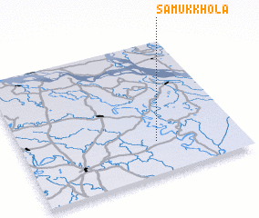 Places with similar names to Sāmukkhola, Bangladesh ::
// Smoky Hollow (US)
// Smokey Hollow (US)
// Sāmukkhola (BD)
// Simākhāli (BD)
// Sāmākhiāli (IN)
// Samkhāl (IN)
// Sāmi Khel (PK)
// Sam Khel (PK)
// Sām Khel (PK)
// Xóm Khe Lỗ (VN)
Disclaimer :: Information on this page comes without warranty of any kind |
||
|
Where is Sāmukkhola? Elevation and coordinates ::
Latitude (lat): 23°15'0"N Longitude (lon): 89°37'0"E
Elevation (approx.): 11m (map arrows pan, magnifying glasses zoom) |
||
|
Visiting Sāmukkhola? Hotel/Accommodation ::
Book a hotel in Sāmukkhola Travel Guide ::
Buy a travel guide for Bangladesh rental cars ::
car rental offers GPS waypoint ::
download a GPX waypoint (PoI) of Sāmukkhola for your GPS receiver
|
||