|
search place name
|
||
South Bāsura (Barisāl, Bangladesh)South Bāsura is a town in the Barisāl region of Bangladesh. An overview map of the region around South Bāsura is displayed below.
regional and 3d topo map of South Bāsura, Bangladesh ::

South Bāsura airports ::
The nearest airport is IXA - Agartala, located 85.8 km north of South Bāsura.
Other airports nearby include CGP - Chittagong Shah Amanat Intl (105.4 km south), DAC - Dhaka Zia Intl (131.8 km north west), IXH - Kailashahar (142.7 km north east), AJL - Aizwal Aizawl (155.5 km north east), Nearby towns ::
North Srīpur (1.9km south) //
North Bāsura (1.9km north) //
Middle Bāsura (2.5km north west) //
South Srīpur (3.7km south) //
Ghaniāmora (4.1km north east) //
Bakshmohammed (5.1km north east) //
Fulgāzi (5.0km east) //
Ānandapur (5.8km south) //
Sātkuchia (5.8km north) //
Chithalia (6.5km north) //
North Sonāpur (6.3km north west) //
Amjadhāt (7.1km east) //
Alāka (7.6km north) //
Hindubāri (7.1km east) //
Muhammadpur (7.8km north east) //
Anjadhat (8.1km east) //
North Sātāra (10.1km south east) //
Mohamaya (10.1km south east) //
[all distances 'as the bird flies' and approximate] 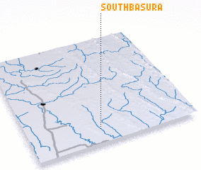 Places with similar names to South Bāsura, Bangladesh :: Disclaimer :: Information on this page comes without warranty of any kind |
||
|
Where is South Bāsura? Elevation and coordinates ::
Latitude (lat): 23°8'0"N Longitude (lon): 91°26'0"E
Elevation (approx.): 10m (map arrows pan, magnifying glasses zoom) |
||
|
Visiting South Bāsura? Hotel/Accommodation ::
Book a hotel in South Bāsura Travel Guide ::
Buy a travel guide for Bangladesh rental cars ::
car rental offers GPS waypoint ::
download a GPX waypoint (PoI) of South Bāsura for your GPS receiver
|
||