|
search place name
|
||
Dévé (Benin)Dévé is a town in Benin. An overview map of the region around Dévé is displayed below.
regional and 3d topo map of Dévé, Benin ::

Dévé airports ::
The nearest airport is LFW - Lome Gnassingbe Eyadema Intl, located 80.6 km south west of Dévé.
Other airports nearby include COO - Cotonou Cadjehoun (91.4 km south east), LOS - Lagos Murtala Muhammed (184.1 km east), ACC - Accra Kotoka Intl (240.2 km south west), Nearby towns ::
Dahoué (1.9km north) //
Niavo (1.9km south) //
Adidévo (2.6km north west) //
Agnavou (2.6km south east) //
Koyohoué (3.7km north) //
Doumahou (3.7km north) //
Agohoué-Balimé (4.1km north west) //
Gnanouhoué (5.9km north) //
Vénahoué (5.9km north) //
Tangaramé (5.9km south) //
Ayomi (5.8km east) //
Djirekpon (5.8km west) //
Agbodranfo (5.8km east) //
Kpoba (6.7km north west) //
Adjiga (7.4km south) //
Amédenta (7.4km south) //
Hédéhoué (7.6km north) //
Gbanavé (7.6km east) //
Hosahoué (7.6km north) //
Ouédémè (7.6km south) //
Kpodaha (8.3km north east) //
Dogbo Hahomé (8.2km north east) //
Dondji-Zouin (8.3km south west) //
Lakata Kondji (8.2km south west) //
[all distances 'as the bird flies' and approximate] 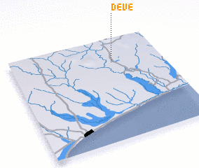 Places with similar names to Dévé, Benin ::
Disclaimer :: Information on this page comes without warranty of any kind |
||
|
Where is Dévé? Elevation and coordinates ::
Latitude (lat): 6°46'0"N Longitude (lon): 1°40'0"E
Elevation (approx.): 47m (map arrows pan, magnifying glasses zoom) |
||
|
Visiting Dévé? Hotel/Accommodation ::
Book a hotel in Dévé Travel Guide ::
Buy a travel guide for Benin rental cars ::
car rental offers GPS waypoint ::
download a GPX waypoint (PoI) of Dévé for your GPS receiver
|
||