|
search place name
|
||
Samétienga (Burkina Faso)Samétienga is a town in Burkina Faso. An overview map of the region around Samétienga is displayed below.
regional and 3d topo map of Samétienga, Burkina Faso ::

Samétienga airports ::
The nearest airport is OUA - Ouagadougou, located 157.0 km south east of Samétienga.
Other airports nearby include MZI - Mopti Ambodedjo (219.1 km north west), Nearby towns ::
Lougouri (1.9km south) //
Sonkouissi (2.6km south west) //
Nogo (2.6km north west) //
Soussou (4.1km south west) //
Gourbaré (4.1km south west) //
Réko (4.1km south east) //
Baghélogo (5.8km north) //
Tibtanga (5.7km west) //
Oula (5.8km south) //
Kao (6.6km south east) //
Tilli (6.6km south west) //
Ouro (7.4km south) //
Kononga (7.4km north) //
Nongo (7.6km north) //
Longa (7.4km east) //
Rèka (7.8km south west) //
Gourga (8.1km north west) //
Kourba (9.2km south west) //
Kourbobagaré (10.3km south west) //
[all distances 'as the bird flies' and approximate] 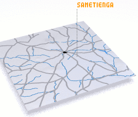 Places with similar names to Samétienga, Burkina Faso ::
// Samadang (MM)
// Samdang (MM)
// Sam-tang (MM)
// Ciemiętniki (PL)
// Śmietanki (PL)
// Cimdenieki (LV)
// Samtenga (BF)
// Sèmtenga (BF)
// Samudongo (CD)
// Samutenga (CD)
Disclaimer :: Information on this page comes without warranty of any kind |
||
|
Where is Samétienga? Elevation and coordinates ::
Latitude (lat): 13°32'0"N Longitude (lon): 2°19'0"W
Elevation (approx.): 320m (map arrows pan, magnifying glasses zoom) |
||
|
Visiting Samétienga? Hotel/Accommodation ::
Book a hotel in Samétienga Travel Guide ::
rental cars ::
car rental offers GPS waypoint ::
download a GPX waypoint (PoI) of Samétienga for your GPS receiver
|
||