|
search place name
|
||
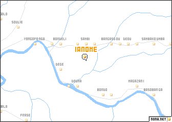
Ia Nomé (Central African Republic)Ia Nomé is a town in Central African Republic. An overview map of the region around Ia Nomé is displayed below.
regional and 3d topo map of Ia Nomé, Central African Republic ::
Nearby towns ::
Sambi (3.7km north) //
Banginomé (4.1km north east) //
Banda (4.1km north east) //
Agoumar (4.1km north west) //
Douma (5.9km south) //
Dégé (5.8km west) //
Bondéli (6.7km north west) //
Bangassou (6.7km north east) //
Dégé (6.7km south west) //
Banga (8.3km north east) //
Iongoro (8.3km north west) //
Bondo (8.3km south east) //
Badéfoa (9.3km south east) //
[all distances 'as the bird flies' and approximate]  Places with similar names to Ia Nomé, Central African Republic ::
Disclaimer :: Information on this page comes without warranty of any kind |
||
|
Where is Ia Nomé? Elevation and coordinates ::
Latitude (lat): 4°48'0"N Longitude (lon): 23°4'0"E
Elevation (approx.): 533m (map arrows pan, magnifying glasses zoom) |
||
|
Visiting Ia Nomé? Hotel/Accommodation ::
Book a hotel in Ia Nomé Travel Guide ::
rental cars ::
car rental offers GPS waypoint ::
download a GPX waypoint (PoI) of Ia Nomé for your GPS receiver
|
||