|
search place name
|
||
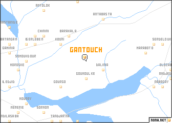
Gantouch (Ouaddaï, Chad)Gantouch is a town in the Ouaddaï region of Chad. An overview map of the region around Gantouch is displayed below.
regional and 3d topo map of Gantouch, Chad ::
Gantouch airports ::
The nearest airport is AEH - Abeche, located 117.5 km north west of Gantouch.
Nearby towns ::
 Places with similar names to Gantouch, Chad ::
// Kantaučiai (LT)
// Kentaučiai (LT)
// Gandichi (RU)
// Kandyshi (RU)
// Kundysh (RU)
// Gantchou (CG)
// Gondoch (IN)
// Gundi Shāh (IN)
// Cantichia (MX)
// Ganatcha (NE)
Disclaimer :: Information on this page comes without warranty of any kind |
||
|
Where is Gantouch? Elevation and coordinates ::
Latitude (lat): 12°55'0"N Longitude (lon): 21°22'0"E
Elevation (approx.): 560m (map arrows pan, magnifying glasses zoom) |
||
|
Visiting Gantouch? Hotel/Accommodation ::
Book a hotel in Gantouch Travel Guide ::
Buy a travel guide for Chad rental cars ::
car rental offers GPS waypoint ::
download a GPX waypoint (PoI) of Gantouch for your GPS receiver
|
||