|
search place name
|
||
El Lucero (Boyacá, Colombia)El Lucero is a town in the Boyacá region of Colombia. An overview map of the region around El Lucero is displayed below.
regional and 3d topo map of El Lucero, Colombia ::

El Lucero airports ::
The nearest airport is MDE - Rio Negro Jose Maria Cordova, located 110.9 km west of El Lucero.
Other airports nearby include OTU - Otu (114.3 km north), EOH - Medellin Olaya Herrera (130.1 km west), EJA - Barrancabermeja Yariguies (131.2 km north east), BOG - Bogota Eldorado Intl (148.8 km south), Nearby towns ::
Campamento La Fidela (0.8km south) //
Villa Clara (2.8km south) //
Agualinda (3.3km north west) //
Tenere (3.6km west) //
Buenos Aires (3.7km south) //
Pozo Boyaca Número Dos (4.0km south east) //
La Arama (6.3km east) //
La Guajira (6.6km north east) //
Bateria Número Dos Velasquez (6.7km west) //
La Suiza (8.0km south) //
La Reforma (8.2km east) //
La Cabaña (8.4km west) //
Las Delicias (8.6km south) //
Dos Hermanos (8.8km east) //
Velásquez (9.3km south west) //
J. P. Cárdenas (10.5km south west) //
[all distances 'as the bird flies' and approximate] 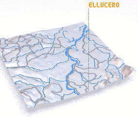 Places with similar names to El Lucero, Colombia ::
Disclaimer :: Information on this page comes without warranty of any kind |
||
|
Where is El Lucero? Elevation and coordinates ::
Latitude (lat): 6°0'58"N Longitude (lon): 74°25'57"W
Elevation (approx.): 145m (map arrows pan, magnifying glasses zoom) |
||
|
Visiting El Lucero? Hotel/Accommodation ::
Book a hotel in El Lucero Travel Guide ::
Buy a travel guide for Colombia rental cars ::
car rental offers GPS waypoint ::
download a GPX waypoint (PoI) of El Lucero for your GPS receiver
|
||