|
search place name
|
||
La Floresta (Valle del Cauca, Colombia)La Floresta is a town in the Valle del Cauca region of Colombia. An overview map of the region around La Floresta is displayed below.
regional and 3d topo map of La Floresta, Colombia ::

La Floresta airports ::
The nearest airport is CLO - Cali Alfonso Bonilla Aragon Intl, located 36.7 km west of La Floresta.
Other airports nearby include ULQ - Tulua Farfan (51.7 km north), AXM - Armenia El Eden (94.8 km north), BUN - Buenaventura Gerardo Tobar Lopez (104.0 km west), NVA - Neiva Benito Salas (115.9 km south east), Nearby towns ::
El Fuerte (0.6km north east) //
Tiatino (1.2km south west) //
El Arado (1.6km north east) //
Chinche Viejo (1.9km west) //
Carrizal (2.5km west) //
La Mesa (2.9km north east) //
Los Naranjos (3.2km south east) //
Satianazo (3.2km south) //
Rosa Zárate (3.6km north) //
Hato Lejos (3.6km east) //
Santa Lucía (3.7km south west) //
Toche (3.8km south west) //
Alvecia (4.0km west) //
Nápoles (4.4km north east) //
Les Dalias (4.6km east) //
La Argelia (4.7km south east) //
Los Sauces (4.8km south west) //
El Brillante (5.0km north west) //
Aují (5.7km south west) //
Nápoles (5.9km east) //
Balcones (6.0km north east) //
La Cristalina (6.0km south east) //
La Palma (6.5km north) //
Combia (6.8km north east) //
San Antonio (6.9km north east) //
La Esmeralda (7.1km south) //
Salina (7.3km south west) //
Cajambre (7.3km east) //
Piedra Gorda (7.4km north west) //
[all distances 'as the bird flies' and approximate] 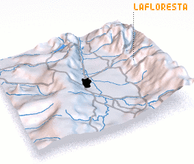 Places with similar names to La Floresta, Colombia ::
// La Florecita (PA)
// La Florecita (CO)
// La Floresta (CO)
// La Floresta (CO)
// La Floresta (CO)
// La Floresta (CO)
// La Floresta (CO)
// La Floresta (CO)
// La Floresta (CO)
// La Floresta (CO)
Disclaimer :: Information on this page comes without warranty of any kind |
||
|
Where is La Floresta? Elevation and coordinates ::
Latitude (lat): 3°39'5"N Longitude (lon): 76°4'8"W
Elevation (approx.): 1851m (map arrows pan, magnifying glasses zoom) |
||
|
Visiting La Floresta? Hotel/Accommodation ::
Book a hotel in La Floresta Travel Guide ::
Buy a travel guide for Colombia rental cars ::
car rental offers GPS waypoint ::
download a GPX waypoint (PoI) of La Floresta for your GPS receiver
|
||