|
search place name
|
||
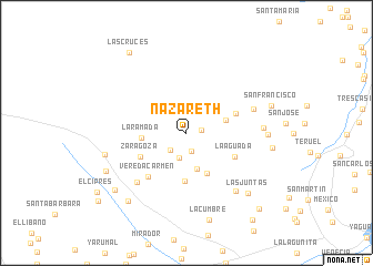
Nazareth (Huila, Colombia)Nazareth is a town in the Huila region of Colombia. An overview map of the region around Nazareth is displayed below.
regional and 3d topo map of Nazareth, Colombia ::
Nazareth airports ::
The nearest airport is NVA - Neiva Benito Salas, located 47.9 km north east of Nazareth.
Other airports nearby include PPN - Popayan Guillermo Leon Valencia (108.6 km west), CLO - Cali Alfonso Bonilla Aragon Intl (116.4 km north west), SVI - San Vincente De Caguan Eduardo Falla Solano (122.0 km south east), FLA - Florencia Gustavo Artunduaga Paredes (130.2 km south), Nearby towns ::
El Caracol (1.6km east) //
La Petilla (1.9km south) //
La Tribuna (2.4km south west) //
San Miguel (2.6km south) //
San Pacho (3.8km south) //
El Cielo (4.1km east) //
La Ramada (4.5km west) //
La Ceiba (4.6km south east) //
Potreros (4.9km south) //
Zaragoza (5.2km south west) //
La Auxilia (5.4km east) //
La Aguada (5.4km south east) //
Vereda Carmen (5.8km south west) //
El Carmen (7.0km south west) //
Honduras (7.2km east) //
Jao (7.7km south east) //
El Ingenio (7.8km east) //
Bajo Cielo (8.2km east) //
La Lulera (8.5km west) //
Las Juntas (8.7km south east) //
San Antonio (8.7km east) //
Los Andes (9.0km south west) //
Las Dalias (9.0km south west) //
San Francisco (9.0km east) //
La Cumbre (9.1km south) //
Los Andes (9.2km south west) //
Las Cruces (9.9km north west) //
Bodega (10.5km south east) //
El Diamante (11.0km south east) //
[all distances 'as the bird flies' and approximate]  Places with similar names to Nazareth, Colombia ::
Disclaimer :: Information on this page comes without warranty of any kind |
||
|
Where is Nazareth? Elevation and coordinates ::
Latitude (lat): 2°45'39"N Longitude (lon): 75°40'53"W
Elevation (approx.): 2111m (map arrows pan, magnifying glasses zoom) |
||
|
Visiting Nazareth? Hotel/Accommodation ::
Book a hotel in Nazareth Travel Guide ::
Buy a travel guide for Colombia rental cars ::
car rental offers GPS waypoint ::
download a GPX waypoint (PoI) of Nazareth for your GPS receiver
|
||