|
search place name
|
||
San Agustín (Huila, Colombia)San Agustín is a town in the Huila region of Colombia. An overview map of the region around San Agustín is displayed below.
regional and 3d topo map of San Agustín, Colombia ::

San Agustín airports ::
The nearest airport is NVA - Neiva Benito Salas, located 56.6 km north east of San Agustín.
Other airports nearby include SVI - San Vincente De Caguan Eduardo Falla Solano (108.1 km south east), PPN - Popayan Guillermo Leon Valencia (108.4 km west), FLA - Florencia Gustavo Artunduaga Paredes (109.5 km south), CLO - Cali Alfonso Bonilla Aragon Intl (134.9 km north west), Nearby towns ::
Santa Teresa (1.2km north east) //
Ambica (2.7km north west) //
Chaparro (2.9km north east) //
Santa Lucía (3.4km east) //
San Martín (4.0km south west) //
La Ensillada (4.8km south east) //
Las Mesitas (4.8km north east) //
El Hoyo (5.2km north east) //
El Guamal (5.4km north) //
San Mateo (5.6km north east) //
El Carrizal (6.0km south east) //
Caracal (6.5km north east) //
La Manga (6.8km west) //
Pacarní (7.2km north west) //
La Trinchera (7.4km north) //
Tierra Loca (7.6km west) //
El Limpiadero (7.7km south west) //
Cajamarca (7.9km north east) //
Rural Mixta (7.9km south east) //
Buenos Aires (8.0km east) //
Los Yuyos (8.3km west) //
Íquira (8.7km north) //
Íquira (8.7km north) //
El Aguacate (8.7km north west) //
El Viso (9.0km south) //
El Dave (9.1km west) //
Domingo Arias (9.1km north east) //
El Viso (9.2km west) //
La Esperanza (9.2km north west) //
[all distances 'as the bird flies' and approximate] 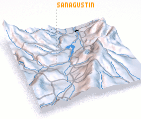 Places with similar names to San Agustín, Colombia ::
// San Agustin (US)
// San Augustine (US)
// San Agustín (PA)
// San Agustín (PA)
// San Agustín (CU)
// San Agustín (CU)
// San Agustín (CU)
// San Agustín (CU)
// San Agustín (CU)
// San Agustín (CU)
Disclaimer :: Information on this page comes without warranty of any kind |
||
|
Where is San Agustín? Elevation and coordinates ::
Latitude (lat): 2°34'34"N Longitude (lon): 75°38'31"W
Elevation (approx.): 867m (map arrows pan, magnifying glasses zoom) |
||
|
Visiting San Agustín? Hotel/Accommodation ::
Book a hotel in San Agustín Travel Guide ::
Buy a travel guide for Colombia rental cars ::
car rental offers GPS waypoint ::
download a GPX waypoint (PoI) of San Agustín for your GPS receiver
|
||