|
search place name
|
||
Santa Anita (Cauca, Colombia)Santa Anita is a town in the Cauca region of Colombia. An overview map of the region around Santa Anita is displayed below.
regional and 3d topo map of Santa Anita, Colombia ::

Santa Anita airports ::
The nearest airport is PPN - Popayan Guillermo Leon Valencia, located 24.0 km south of Santa Anita.
Other airports nearby include CLO - Cali Alfonso Bonilla Aragon Intl (99.3 km north), BUN - Buenaventura Gerardo Tobar Lopez (134.6 km north), GPI - Guapi Juan Casiano (145.8 km west), NVA - Neiva Benito Salas (147.5 km east), Nearby towns ::
El Carmen (1.6km north west) //
La Tribuna (2.7km north) //
La Aurelia (3.0km south east) //
La Granja (3.3km south west) //
El Líbano (3.4km north east) //
San Miguel (3.6km north) //
Cuatro Esquinas (4.2km east) //
San Bernardo (4.3km north west) //
La Aurelia (4.4km south east) //
San José (4.5km north east) //
La Pedregosa (4.7km west) //
La Saltana (4.7km north) //
Altamira (4.9km north) //
Octavio (5.1km north east) //
Corrales (5.1km east) //
Santa Helena (5.6km north west) //
Crucero Playa Rica (5.7km north) //
Santa Bárbara (5.8km south west) //
El Crucero (6.2km north west) //
Cajibío (6.3km south west) //
Santa Helena (6.3km north west) //
La Aurora (6.3km north) //
Uvales (6.5km north) //
Matarredonda (6.5km north) //
Tunía (6.6km east) //
Carrizal (6.8km north) //
La Pedregosa (6.8km west) //
El Hogar (7.1km north east) //
El Hogar (7.3km north east) //
[all distances 'as the bird flies' and approximate] 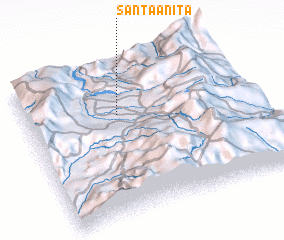 Places with similar names to Santa Anita, Colombia ::
// Santa Anita (BR)
// Santa Anita (US)
// San Donato (IT)
// San Donato (IT)
// San Donato (IT)
// San Donato (IT)
// San Donato (IT)
// San Donato (IT)
// San Donato (IT)
// San Donato (IT)
Disclaimer :: Information on this page comes without warranty of any kind |
||
|
Where is Santa Anita? Elevation and coordinates ::
Latitude (lat): 2°40'13"N Longitude (lon): 76°35'29"W
Elevation (approx.): 1791m (map arrows pan, magnifying glasses zoom) |
||
|
Visiting Santa Anita? Hotel/Accommodation ::
Book a hotel in Santa Anita Travel Guide ::
Buy a travel guide for Colombia rental cars ::
car rental offers GPS waypoint ::
download a GPX waypoint (PoI) of Santa Anita for your GPS receiver
|
||