|
search place name
|
||
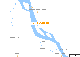
Santa Sofía (Amazonas, Colombia)Santa Sofía is a town in the Amazonas region of Colombia. An overview map of the region around Santa Sofía is displayed below.
regional and 3d topo map of Santa Sofía, Colombia ::
Santa Sofía airports ::
The nearest airport is LET - Leticia Alfredo Vasquez Cobo, located 30.4 km south east of Santa Sofía.
Other airports nearby include TBT - Tabatinga (36.0 km south east), Nearby towns ::
Yauma (7.2km south) //
Internado Santa Sofia (7.8km north) //
[all distances 'as the bird flies' and approximate]  Places with similar names to Santa Sofía, Colombia ::
// Suntsovo (RU)
// Suntsovo (RU)
// Santa Sofia (BR)
// Zentsevo (RU)
// Zentsovo (RU)
// Zentsovo (RU)
// Zintsovo (RU)
// Santa Sofia (PT)
// Santa Sofía (CU)
// Santa Sofía (CU)
Disclaimer :: Information on this page comes without warranty of any kind |
||
|
Where is Santa Sofía? Elevation and coordinates ::
Latitude (lat): 4°0'11"S Longitude (lon): 70°8'24"W
Elevation (approx.): 81m (map arrows pan, magnifying glasses zoom) |
||
|
Visiting Santa Sofía? Hotel/Accommodation ::
Book a hotel in Santa Sofía Travel Guide ::
Buy a travel guide for Colombia rental cars ::
car rental offers GPS waypoint ::
download a GPX waypoint (PoI) of Santa Sofía for your GPS receiver
|
||