|
search place name
|
||
Tequendama (Magdalena, Colombia)Tequendama is a town in the Magdalena region of Colombia. An overview map of the region around Tequendama is displayed below.
regional and 3d topo map of Tequendama, Colombia ::

Tequendama airports ::
The nearest airport is SMR - Santa Marta Simon Bolivar, located 63.2 km north of Tequendama.
Other airports nearby include BAQ - Barranquilla Ernesto Cortissoz (75.4 km north west), VUP - Valledupar Alfonso Lopez Pumarejo (103.0 km east), CTG - Cartagena Rafael Nunez (146.0 km west), MGN - Magangue Baracoa (157.7 km south west), Nearby towns ::
Macaraquilla (1.9km north) //
Buenos Aires (1.9km south) //
La Bogotana (1.8km west) //
Fundación (3.2km south) //
Ligia y Ruth (4.1km south east) //
Polvorita (4.1km north west) //
El Encaje (4.1km south west) //
Santo Tomás (4.1km north west) //
Casablanca (4.1km north west) //
La Colombia (4.1km north west) //
Aracataca (4.8km north) //
Bocatoma (5.2km south east) //
Andalucía (5.2km north west) //
La Corona (5.5km west) //
Santa Bárbara (5.9km north) //
Lorena (5.9km south) //
Arizona (5.8km east) //
Cacao (5.9km north) //
Las Mercedes (6.6km north east) //
San Antonio (6.6km south east) //
La Victoria (6.6km south east) //
San Miguel (6.6km south east) //
Palenque (6.6km north west) //
El Destino (6.6km south west) //
San Lorenzo (6.6km south west) //
La Pradera (7.6km north) //
Control (7.6km north) //
La Habana (7.6km south) //
Lourdes María (7.8km north west) //
[all distances 'as the bird flies' and approximate] 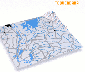 Places with similar names to Tequendama, Colombia ::
// Tequendama (CO)
// Tequendama (CO)
// Tequendama (CO)
// Tequendama (CO)
// Dignïétoumba (GA)
// Doukendema (GA)
// Takantami (NE)
// Decântem (GW)
Disclaimer :: Information on this page comes without warranty of any kind |
||
|
Where is Tequendama? Elevation and coordinates ::
Latitude (lat): 10°33'0"N Longitude (lon): 74°11'0"W
Elevation (approx.): 39m (map arrows pan, magnifying glasses zoom) |
||
|
Visiting Tequendama? Hotel/Accommodation ::
Book a hotel in Tequendama Travel Guide ::
Buy a travel guide for Colombia rental cars ::
car rental offers GPS waypoint ::
download a GPX waypoint (PoI) of Tequendama for your GPS receiver
|
||