|
search place name
|
||
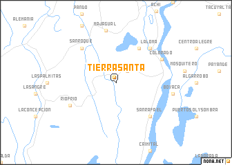
Tierra Santa (Sucre, Colombia)Tierra Santa is a town in the Sucre region of Colombia. An overview map of the region around Tierra Santa is displayed below.
regional and 3d topo map of Tierra Santa, Colombia ::
Tierra Santa airports ::
The nearest airport is MGN - Magangue Baracoa, located 93.9 km north of Tierra Santa.
Other airports nearby include CZU - Corozal Las Brujas (120.8 km north west), MTR - Monteria Los Garzones (138.8 km west), OCV - Ocana Aguas Claras (139.6 km east), OTU - Otu (161.4 km south), Nearby towns ::
Palmaritico (2.6km north east) //
El Palmar (6.7km north east) //
San Rafael (7.8km south east) //
San Roque (7.8km north west) //
La Loma (7.8km north east) //
Río Frío (8.2km south west) //
Colorado (8.2km north east) //
Majagual (8.6km north) //
[all distances 'as the bird flies' and approximate]  Places with similar names to Tierra Santa, Colombia ::
// Tursunt (RU)
// Tarzent (MA)
// Tierrasanta (US)
// Dražin Do (BA)
// Taračin Do (BA)
// Trăsnitu (RO)
// Terrace End (NZ)
// Tresend (US)
// Dursundia (BD)
// Tierra Santa (CO)
Disclaimer :: Information on this page comes without warranty of any kind |
||
|
Where is Tierra Santa? Elevation and coordinates ::
Latitude (lat): 8°28'0"N Longitude (lon): 74°37'0"W
Elevation (approx.): 21m (map arrows pan, magnifying glasses zoom) |
||
|
Visiting Tierra Santa? Hotel/Accommodation ::
Book a hotel in Tierra Santa Travel Guide ::
Buy a travel guide for Colombia rental cars ::
car rental offers GPS waypoint ::
download a GPX waypoint (PoI) of Tierra Santa for your GPS receiver
|
||