|
search place name
|
||
Villanueva (Córdoba, Colombia)Villanueva is a town in the Córdoba region of Colombia. An overview map of the region around Villanueva is displayed below.
regional and 3d topo map of Villanueva, Colombia ::

Villanueva airports ::
The nearest airport is MTR - Monteria Los Garzones, located 45.8 km south of Villanueva.
Other airports nearby include CZU - Corozal Las Brujas (54.0 km east), MGN - Magangue Baracoa (101.3 km east), CTG - Cartagena Rafael Nunez (136.6 km north), BAQ - Barranquilla Ernesto Cortissoz (212.7 km north east), Nearby towns ::
Los Corrales (0.0km north) //
San Sebastián (3.7km west) //
Purísima (4.5km east) //
Lorica (5.8km west) //
La Palma (6.6km south west) //
Comején (6.6km north east) //
La Peinada (7.6km south) //
Tijeretas (7.6km north) //
Bijao (8.3km north east) //
Nariño (10.4km south west) //
Betulia (10.4km north east) //
Bella Vista (10.4km north east) //
[all distances 'as the bird flies' and approximate] 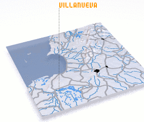 Places with similar names to Villanueva, Colombia ::
// Val'nëvo (RU)
// Villa Nueva (BO)
// Villa Nueva (BO)
// Villa Nueva (BO)
// Volynovo (RU)
// Vila Nova (PT)
// Vila Nova (PT)
// Vila Nova (PT)
// Vila Nova (PT)
// Vila Nova (PT)
Disclaimer :: Information on this page comes without warranty of any kind |
||
|
Where is Villanueva? Elevation and coordinates ::
Latitude (lat): 9°14'0"N Longitude (lon): 75°46'0"W
Elevation (approx.): 4m (map arrows pan, magnifying glasses zoom) |
||
|
Visiting Villanueva? Hotel/Accommodation ::
Book a hotel in Villanueva Travel Guide ::
Buy a travel guide for Colombia rental cars ::
car rental offers GPS waypoint ::
download a GPX waypoint (PoI) of Villanueva for your GPS receiver
|
||