|
search place name
|
||
Tandou-Bèndé (Kouilou, Congo, Republic of the)Tandou-Bèndé is a town in the Kouilou region of Congo, Republic of the. An overview map of the region around Tandou-Bèndé is displayed below.
regional and 3d topo map of Tandou-Bèndé, Congo, Republic of the ::

Tandou-Bèndé airports ::
The nearest airport is PNR - Pointe-noire Pointe Noire, located 16.6 km north west of Tandou-Bèndé.
Other airports nearby include CAB - Cabinda (76.4 km south), MNB - Muanda (117.3 km south), SZA - Soyo (139.9 km south), Nearby towns ::
Kotchi (0.4km north west) //
Fouta (1.4km south east) //
Djéno (3.3km north west) //
Sanza (3.9km east) //
Kangala (7.3km north) //
Tiamba (7.7km south east) //
Boulotombi (7.7km north east) //
Kivangani (8.0km east) //
Tchilimbi (8.2km north) //
Tilala (8.6km north) //
Nanga Loango (8.7km north west) //
Nzassi (9.1km south east) //
Mbanga (9.4km north east) //
Cote-Matève (9.8km north west) //
Bondo (10.4km south east) //
[all distances 'as the bird flies' and approximate] 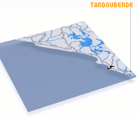 Places with similar names to Tandou-Bèndé, Congo, Republic of the ::
// Tāntibanda (BD)
// Tondibanda (BJ)
// Tondi Banda (NE)
// Tondi Banda (NE)
// Danda Bānda (PK)
// Dandai Bānda (PK)
// Dandai Bānda (PK)
// Dando Bānda (PK)
// Tantabanda (PE)
// Dand Bānda (PK)
Disclaimer :: Information on this page comes without warranty of any kind |
||
|
Where is Tandou-Bèndé? Elevation and coordinates ::
Latitude (lat): 4°56'33"S Longitude (lon): 11°58'1"E
Elevation (approx.): 13m (map arrows pan, magnifying glasses zoom) |
||
|
Visiting Tandou-Bèndé? Hotel/Accommodation ::
Book a hotel in Tandou-Bèndé Travel Guide ::
rental cars ::
car rental offers GPS waypoint ::
download a GPX waypoint (PoI) of Tandou-Bèndé for your GPS receiver
|
||