|
search place name
|
||
Nonkikan (Timor Timur, East Timor)Nonkikan is a town in the Timor Timur region of East Timor. An overview map of the region around Nonkikan is displayed below.
regional and 3d topo map of Nonkikan, East Timor ::

Nonkikan airports ::
The nearest airport is DIL - Dili Presidente Nicolau Lobato Intl, located 158.7 km north east of Nonkikan.
Nearby towns ::
Kiubiole (0.4km north) //
Fatututa (0.5km south) //
Mambua (0.7km south) //
Loel (0.7km north west) //
Bono (1.0km north) //
Nunete (1.1km south) //
Tuames (1.2km north west) //
Oesilo (1.5km north) //
Kiubatan (1.5km north west) //
Oebaki (1.5km north west) //
Bambai (1.7km west) //
Tumin (1.8km south) //
Besemese (1.8km north west) //
Tobo (1.9km north west) //
Ukbatan (2.1km south east) //
Sipin (2.1km west) //
Fauteso (2.3km south) //
Kuangkiu (2.5km west) //
Kuafeu (2.5km east) //
Asabat (2.7km north west) //
Nobeat (2.9km west) //
Kiubiselo (3.0km south) //
Oepauk (3.0km west) //
Patmet (3.2km north east) //
Kuanobe (3.5km west) //
Binau (3.5km south) //
Kisan (3.7km south west) //
Saben (3.8km north east) //
Pune (3.8km west) //
[all distances 'as the bird flies' and approximate] 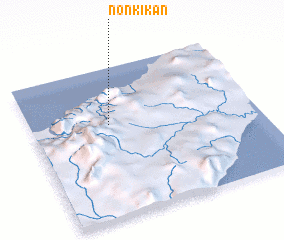 Places with similar names to Nonkikan, East Timor ::
Disclaimer :: Information on this page comes without warranty of any kind |
||
|
Where is Nonkikan? Elevation and coordinates ::
Latitude (lat): 9°22'47"S Longitude (lon): 124°21'1"E
Elevation (approx.): 519m (map arrows pan, magnifying glasses zoom) |
||
|
Visiting Nonkikan? Hotel/Accommodation ::
Book a hotel in Nonkikan Travel Guide ::
Buy a travel guide for East Timor rental cars ::
car rental offers GPS waypoint ::
download a GPX waypoint (PoI) of Nonkikan for your GPS receiver
|
||