|
search place name
|
||
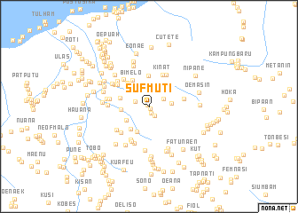
Sufmuti (Timor Timur, East Timor)Sufmuti is a town in the Timor Timur region of East Timor. An overview map of the region around Sufmuti is displayed below.
regional and 3d topo map of Sufmuti, East Timor ::
Sufmuti airports ::
The nearest airport is DIL - Dili Presidente Nicolau Lobato Intl, located 149.8 km north east of Sufmuti.
Nearby towns ::
Nubani (0.2km south east) //
Bonemese (0.3km north west) //
Noke (0.9km south) //
Nuabatan (1.3km south east) //
Maonnese (1.9km west) //
Tenae (2.0km north east) //
Nunsena (2.7km east) //
Kafun (3.2km north west) //
Oenoa (3.3km south west) //
Kiukole (3.5km north west) //
Hueneno (3.5km south west) //
Kiukle (3.5km west) //
Biele (3.6km south west) //
Bobonoe (3.8km west) //
Taolen (3.9km north) //
Nunuhle (3.9km north west) //
Bimelo (3.9km north west) //
Kiubose (4.0km north west) //
Kinat (4.3km north) //
Laukfoan (4.4km east) //
Bussi (4.5km north east) //
Bobometo (4.7km south west) //
Bihala (4.7km north west) //
Afumalule (4.7km south west) //
Usapikolen (4.9km south west) //
Najaimuti (4.9km north west) //
Oemanu (5.0km south) //
Oebelo (5.0km west) //
Benais (5.0km south west) //
[all distances 'as the bird flies' and approximate] 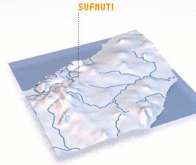 Places with similar names to Sufmuti, East Timor ::
// Şūfī Aḩmad (IR)
Disclaimer :: Information on this page comes without warranty of any kind |
||
|
Where is Sufmuti? Elevation and coordinates ::
Latitude (lat): 9°18'44"S Longitude (lon): 124°24'6"E
Elevation (approx.): 471m (map arrows pan, magnifying glasses zoom) |
||
|
Visiting Sufmuti? Hotel/Accommodation ::
Book a hotel in Sufmuti Travel Guide ::
Buy a travel guide for East Timor rental cars ::
car rental offers GPS waypoint ::
download a GPX waypoint (PoI) of Sufmuti for your GPS receiver
|
||