|
search place name
|
||
Chagüitón (Santa Ana, El Salvador)Chagüitón is a town in the Santa Ana region of El Salvador. An overview map of the region around Chagüitón is displayed below.
regional and 3d topo map of Chagüitón, El Salvador ::

Chagüitón airports ::
The nearest airport is SAL - San Salvador El Salvador Intl, located 90.3 km south of Chagüitón.
Other airports nearby include GUA - Guatemala City La Aurora (136.7 km west), CBV - Coban (181.6 km north west), SAP - San Pedro Sula La Mesa Intl (202.9 km north east), TEA - Tela (262.6 km north east), Nearby towns ::
Palo Galán (1.8km west) //
Santa Rita Cimarrón (1.8km east) //
Los Ranchos (4.1km north west) //
Santa Rosa Guachipilín (4.0km south west) //
El Matazano (4.1km south west) //
Vega Grande (4.0km south east) //
Cuyuiscat (5.2km north west) //
Lagnetas (5.2km north west) //
San Francisco Apanta (5.2km south west) //
El Salitre (5.4km west) //
La Laguneta (5.6km south) //
La Isla (5.7km west) //
Los Planes (5.8km south) //
Sunapa (5.8km south) //
Las Pavas (5.8km north) //
La Ceibita (6.6km north west) //
San José Capulín (7.2km west) //
El Ahogado (7.4km west) //
Encumbrado (7.4km east) //
Agua Fría (7.4km east) //
El Zapote (7.6km south) //
Las Casitas (7.6km south) //
El Nisperal (7.7km south east) //
San Juan Abajo (8.2km north west) //
Camulián (8.2km north east) //
La Joya (9.1km south west) //
Chilín (9.1km south west) //
El Carrizal (9.1km south west) //
Potenciana (9.2km south east) //
[all distances 'as the bird flies' and approximate] 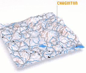 Places with similar names to Chagüitón, El Salvador ::
Disclaimer :: Information on this page comes without warranty of any kind |
||
|
Where is Chagüitón? Elevation and coordinates ::
Latitude (lat): 14°13'0"N Longitude (lon): 89°19'0"W
Elevation (approx.): 900m (map arrows pan, magnifying glasses zoom) |
||
|
Visiting Chagüitón? Hotel/Accommodation ::
Book a hotel in Chagüitón Travel Guide ::
Buy a travel guide for El Salvador rental cars ::
car rental offers GPS waypoint ::
download a GPX waypoint (PoI) of Chagüitón for your GPS receiver
|
||