|
search place name
|
||
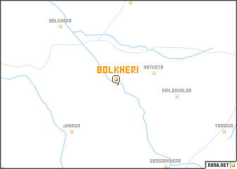
Bolkheri (Madhya Pradesh, India)Bolkheri is a town in the Madhya Pradesh region of India. An overview map of the region around Bolkheri is displayed below.
regional and 3d topo map of Bolkheri, India ::
Bolkheri airports ::
The nearest airport is IDR - Indore Devi Ahilyabai Holkar, located 104.6 km south of Bolkheri.
Other airports nearby include BHO - Bhopal (162.6 km east), KTU - Kota (165.5 km north), UDR - Udaipur (220.3 km north west), Nearby towns ::
 Places with similar names to Bolkheri, India ::
// Bolkheyrī (IR)
// Bū ol Kheyr (IR)
// Bāliākhora (BD)
// Bālikhura (BD)
// Bil Kherua (BD)
// Bālākhera (IN)
// Belkhar (IN)
// Bilkheri (IN)
// Bolkhera (IN)
// Belkhor (SN)
Disclaimer :: Information on this page comes without warranty of any kind |
||
|
Where is Bolkheri? Elevation and coordinates ::
Latitude (lat): 23°40'0"N Longitude (lon): 75°48'0"E
Elevation (approx.): 452m (map arrows pan, magnifying glasses zoom) |
||
|
Visiting Bolkheri? Hotel/Accommodation ::
Book a hotel in Bolkheri Travel Guide ::
Buy a travel guide for India rental cars ::
car rental offers GPS waypoint ::
download a GPX waypoint (PoI) of Bolkheri for your GPS receiver
|
||