|
search place name
|
||
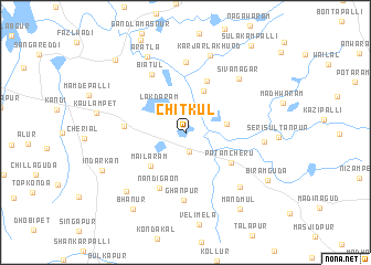
Chitkul (Andhra Pradesh, India)Chitkul is a town in the Andhra Pradesh region of India. An overview map of the region around Chitkul is displayed below.
regional and 3d topo map of Chitkul, India ::
Chitkul airports ::
The nearest airport is HYD - Hyderabad, located 28.4 km south east of Chitkul.
Nearby towns ::
Muttargi (2.0km south) //
Lakdāram (3.6km north west) //
Indrasham (4.0km east) //
Kanjerla Buzurg (4.5km north) //
Mailāram (4.8km south west) //
Patancheru (5.3km south east) //
Kanjerla Khurd (5.6km north) //
Nandigaon (6.1km south west) //
Rudrāwaram (5.9km west) //
Ghanpur (6.8km south) //
Biatul (6.8km north west) //
Begampet (7.1km north) //
Sivanagar (7.4km north east) //
Kāsāreddipalli (7.6km south east) //
Krishnareddipet (7.6km east) //
Karjarla Khurd (8.1km north) //
Kāsāram (8.2km south west) //
Aratla (8.5km north west) //
Indārkan (8.9km south west) //
Bhānūr (9.2km south west) //
Mandmūl (9.3km south east) //
Biramguda (9.2km south east) //
Ismail Khānpet (10.1km north west) //
Sulakampalli (10.8km north east) //
[all distances 'as the bird flies' and approximate]  Places with similar names to Chitkul, India ::
// Chhota Gālua (BD)
// Chhota Kālia (BD)
// Chhota Kuli (BD)
// Chitākul (IN)
// Chitkal (IN)
// Chitkūl (IN)
// Chatkal (UZ)
// Tiatgol (SN)
// Chitukula (ZM)
// Chitukulu (ZM)
Disclaimer :: Information on this page comes without warranty of any kind |
||
|
Where is Chitkul? Elevation and coordinates ::
Latitude (lat): 17°33'32"N Longitude (lon): 78°13'27"E
Elevation (approx.): 525m (map arrows pan, magnifying glasses zoom) |
||
|
Visiting Chitkul? Hotel/Accommodation ::
Book a hotel in Chitkul Travel Guide ::
Buy a travel guide for India rental cars ::
car rental offers GPS waypoint ::
download a GPX waypoint (PoI) of Chitkul for your GPS receiver
|
||