|
search place name
|
||
Citeureup (Jawa Barat, Indonesia)Citeureup is a town in the Jawa Barat region of Indonesia. An overview map of the region around Citeureup is displayed below.
regional and 3d topo map of Citeureup, Indonesia ::

Citeureup airports ::
The nearest airport is CGK - Jakarta Soekarno Hatta Intl, located 143.6 km north west of Citeureup.
Nearby towns ::
Bojongsoang (0.3km east) //
Deyeuhkolot (0.9km south west) //
Bojongloa (1.6km north) //
Pengkolan (2.9km south) //
Bojongmalaka (2.9km south west) //
Buahbatu (3.4km north west) //
Margasari (4.1km north east) //
Citamiang (4.7km west) //
Pameungpeuk (4.9km south west) //
Cibeduyut (5.0km north west) //
Papakgede (5.1km south west) //
Cangkuang (5.1km west) //
Tegallebu (5.7km north east) //
Cangkring (5.9km south east) //
Cipamokoan (6.1km east) //
Kiaracondong (6.2km north) //
Rancalowa (6.5km north east) //
Karees (6.6km north) //
Sumbawa (7.1km north) //
Cikudapateuh (7.5km north) //
Husein Sastranegara (7.6km north west) //
Margahayu (7.6km west) //
Bandung (7.9km north) //
Bojongkunci (8.0km south west) //
Bojongkalong (8.1km east) //
Sapan Dua (8.1km east) //
Arjasari (8.2km south) //
Rahayu (8.4km west) //
Melak (8.6km north west) //
[all distances 'as the bird flies' and approximate] 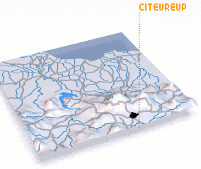 Places with similar names to Citeureup, Indonesia ::
Disclaimer :: Information on this page comes without warranty of any kind |
||
|
Where is Citeureup? Elevation and coordinates ::
Latitude (lat): 6°58'59"S Longitude (lon): 107°37'51"E
Elevation (approx.): 665m (map arrows pan, magnifying glasses zoom) |
||
|
Visiting Citeureup? Hotel/Accommodation ::
Book a hotel in Citeureup Travel Guide ::
Buy a travel guide for Indonesia rental cars ::
car rental offers GPS waypoint ::
download a GPX waypoint (PoI) of Citeureup for your GPS receiver
|
||