|
search place name
|
||
Keladi (Jawa Barat, Indonesia)Keladi is a town in the Jawa Barat region of Indonesia. An overview map of the region around Keladi is displayed below.
regional and 3d topo map of Keladi, Indonesia ::

Keladi airports ::
The nearest airport is CGK - Jakarta Soekarno Hatta Intl, located 52.6 km west of Keladi.
Nearby towns ::
Gombong (0.9km north west) //
Kalenkramat (1.5km south west) //
Karanggetak (1.7km south east) //
Balongasem (2.2km south) //
Kalenremeng (2.4km north west) //
Pulobambu Dua (2.7km east) //
Balongampel (2.8km south west) //
Kedung (2.9km west) //
Pulomunib (2.9km south east) //
Pulolamaran (3.0km north west) //
Balong (3.0km south) //
Galian (3.0km north west) //
Balonggubuk (3.5km south) //
Bulaktemu (3.5km west) //
Pengarengan (3.6km south west) //
Puloapit (3.6km north west) //
Kumejing (3.6km east) //
Gempoltinggi (3.6km west) //
Kobakterate (3.8km west) //
Rengaslempeng (3.8km south) //
Balongrinih (4.1km south) //
Pengarengan-poncol (4.2km south west) //
Pulopanjang (4.4km north) //
Pulorengas (4.4km north) //
Wangkal (4.4km south west) //
Pulonangka (4.4km north) //
Wangkal (4.5km north) //
Pulobantar (4.6km north) //
Pulolandak (4.9km north east) //
[all distances 'as the bird flies' and approximate] 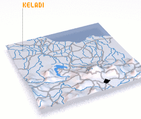 Places with similar names to Keladi, Indonesia ::
Disclaimer :: Information on this page comes without warranty of any kind |
||
|
Where is Keladi? Elevation and coordinates ::
Latitude (lat): 6°7'32"S Longitude (lon): 107°7'51"E
Elevation (approx.): 3m (map arrows pan, magnifying glasses zoom) |
||
|
Visiting Keladi? Hotel/Accommodation ::
Book a hotel in Keladi Travel Guide ::
Buy a travel guide for Indonesia rental cars ::
car rental offers GPS waypoint ::
download a GPX waypoint (PoI) of Keladi for your GPS receiver
|
||