|
search place name
|
||
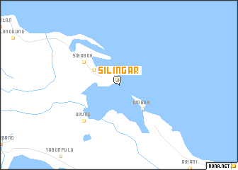
Silingar (Indonesia)Silingar is a town in Indonesia. An overview map of the region around Silingar is displayed below.
regional and 3d topo map of Silingar, Indonesia ::
Silingar airports ::
The nearest airport is GNS - Gunung Sitoli Binaka, located 240.9 km south east of Silingar.
Nearby towns ::
Lugusibabu (4.7km north west) //
Ivabah (5.2km south east) //
Sibaboh (6.7km north west) //
Urung (7.9km south west) //
[all distances 'as the bird flies' and approximate]  Places with similar names to Silingar, Indonesia ::
// Zelënyye Gory (RU)
// Zielona Góra (PL)
// Zielona Góra (PL)
// Zielona Góra (PL)
// Zielona Góra (PL)
// Slonaker (US)
// Sālāinagar (BD)
// Sālnagar (BD)
// Cilinggar (ID)
// Salinggara (ID)
Disclaimer :: Information on this page comes without warranty of any kind |
||
|
Where is Silingar? Elevation and coordinates ::
Latitude (lat): 2°41'0"N Longitude (lon): 96°9'0"E
Elevation (approx.): -32768m (map arrows pan, magnifying glasses zoom) |
||
|
Visiting Silingar? Hotel/Accommodation ::
Book a hotel in Silingar Travel Guide ::
Buy a travel guide for Indonesia rental cars ::
car rental offers GPS waypoint ::
download a GPX waypoint (PoI) of Silingar for your GPS receiver
|
||