|
search place name
|
||
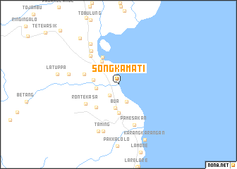
Songkamati (Sulawesi Selatan, Indonesia)Songkamati is a town in the Sulawesi Selatan region of Indonesia. An overview map of the region around Songkamati is displayed below.
regional and 3d topo map of Songkamati, Indonesia ::
Songkamati airports ::
The nearest airport is PSJ - Poso Kasiguncu, located 185.2 km north of Songkamati.
Nearby towns ::
Songka (1.0km north) //
Purangi (2.2km south west) //
Temboklando (2.5km north) //
Padangkalua (3.0km south east) //
Kurung (3.5km west) //
Bua (3.8km south) //
Mawa (4.0km west) //
Beringinjaya (4.4km north west) //
Pabbarassang (4.5km south) //
Palopo (5.0km north west) //
Rantelimbong (5.0km south west) //
Bakabaka (5.7km west) //
Rontekasa (6.0km south west) //
Lebang (6.3km north west) //
Patene (6.8km north west) //
Pamesakan (6.9km south) //
Lemolemo (7.8km north west) //
Taming (7.8km south) //
Ampadang (8.0km west) //
Kombong (8.1km south west) //
Laleng-balandae (9.5km north west) //
Karangkarangan (9.7km south east) //
[all distances 'as the bird flies' and approximate]  Places with similar names to Songkamati, Indonesia :: Disclaimer :: Information on this page comes without warranty of any kind |
||
|
Where is Songkamati? Elevation and coordinates ::
Latitude (lat): 3°1'58"S Longitude (lon): 120°13'16"E
Elevation (approx.): 10m (map arrows pan, magnifying glasses zoom) |
||
|
Visiting Songkamati? Hotel/Accommodation ::
Book a hotel in Songkamati Travel Guide ::
Buy a travel guide for Indonesia rental cars ::
car rental offers GPS waypoint ::
download a GPX waypoint (PoI) of Songkamati for your GPS receiver
|
||