|
search place name
|
||
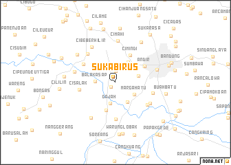
Sukabirus (Jawa Barat, Indonesia)Sukabirus is a town in the Jawa Barat region of Indonesia. An overview map of the region around Sukabirus is displayed below.
regional and 3d topo map of Sukabirus, Indonesia ::
Sukabirus airports ::
The nearest airport is CGK - Jakarta Soekarno Hatta Intl, located 133.0 km north west of Sukabirus.
Nearby towns ::
Cisaat (1.0km south west) //
Lagadar (1.9km north) //
Balakasap (3.3km west) //
Gajah (3.5km south) //
Margahayu (3.6km south east) //
Rahayu (3.7km south east) //
Cimindi-hilir (3.8km north east) //
Melak (3.9km east) //
Legoacau (4.8km south) //
Cimindi (5.1km north east) //
Andir (5.4km north east) //
Batujajar (6.0km north west) //
Muara (6.0km south) //
Cisalak (6.0km west) //
Cibeduyut (6.3km east) //
Cangkuang (6.3km south east) //
Leuwigajah (6.4km north west) //
Citamiang (6.5km south east) //
Cimahi (6.7km north) //
Cihampelas (6.8km west) //
Cibeber-hilir (6.9km north west) //
Pasirwalanda (7.0km south west) //
Husein Sastranegara (7.0km east) //
Cangkorah (7.7km north west) //
Pasirpaku (7.7km north west) //
Cituja (7.8km north east) //
Cicalengka Dua (8.3km west) //
Buahbatu (8.3km east) //
Warunglobak (8.4km south) //
[all distances 'as the bird flies' and approximate]  Places with similar names to Sukabirus, Indonesia ::
// Sukabares (ID)
Disclaimer :: Information on this page comes without warranty of any kind |
||
|
Where is Sukabirus? Elevation and coordinates ::
Latitude (lat): 6°56'28"S Longitude (lon): 107°32'21"E
Elevation (approx.): 683m (map arrows pan, magnifying glasses zoom) |
||
|
Visiting Sukabirus? Hotel/Accommodation ::
Book a hotel in Sukabirus Travel Guide ::
Buy a travel guide for Indonesia rental cars ::
car rental offers GPS waypoint ::
download a GPX waypoint (PoI) of Sukabirus for your GPS receiver
|
||