|
search place name
|
||
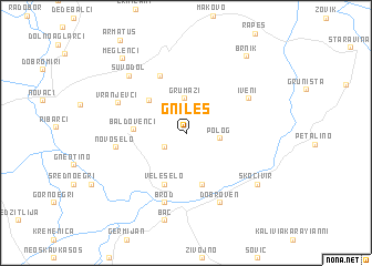
Gnileš (Macedonia, The Republic of)Gnileš is a town in Macedonia, The Republic of. An overview map of the region around Gnileš is displayed below.
regional and 3d topo map of Gnileš, Macedonia, The Republic of ::
Gnileš airports ::
The nearest airport is KSO - Kastoria Aristotelis, located 67.9 km south of Gnileš.
Other airports nearby include OHD - Ohrid (73.3 km west), KZI - Kozani Filippos (83.5 km south), SKP - Skopje (105.4 km north), SKG - Thessaloniki Makedonia (129.1 km south east), Nearby towns ::
Tepavci (2.1km south west) //
Polog (2.6km east) //
Grumazi (3.5km north) //
Paralovo (4.2km north west) //
Baldovenci (4.0km west) //
Slivica (5.3km south) //
Veleselo (5.4km south) //
Orehovo (6.1km north) //
Iveni (5.8km north east) //
Novo Selo (5.6km west) //
Brod (7.2km south) //
Vranjevci (6.0km north west) //
Dobroven (7.4km south) //
Suvodol (7.2km north west) //
Skočivir (7.4km south east) //
Bač (9.0km south) //
Brnik (9.0km north east) //
Meglenci (9.0km north west) //
[all distances 'as the bird flies' and approximate]  Places with similar names to Gnileš, Macedonia, The Republic of ::
Disclaimer :: Information on this page comes without warranty of any kind |
||
|
Where is Gnileš? Elevation and coordinates ::
Latitude (lat): 41°0'46"N Longitude (lon): 21°35'9"E
Elevation (approx.): 856m (map arrows pan, magnifying glasses zoom) |
||
|
Visiting Gnileš? Hotel/Accommodation ::
Book a hotel in Gnileš Travel Guide ::
rental cars ::
car rental offers GPS waypoint ::
download a GPX waypoint (PoI) of Gnileš for your GPS receiver
|
||