|
search place name
|
||
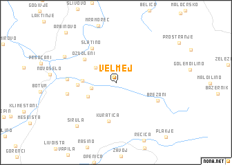
Velmej (Macedonia, The Republic of)Velmej is a town in Macedonia, The Republic of. An overview map of the region around Velmej is displayed below.
regional and 3d topo map of Velmej, Macedonia, The Republic of ::
Velmej airports ::
The nearest airport is OHD - Ohrid, located 18.7 km south west of Velmej.
Other airports nearby include SKP - Skopje (95.0 km north east), TIA - Tirana Rinas (99.7 km west), KSO - Kastoria Aristotelis (99.9 km south), KZI - Kozani Filippos (137.5 km south east), Nearby towns ::
Grko Pole (3.2km west) //
Sošani (3.5km north west) //
Lešani (4.1km south west) //
Gorno Sredoreče (4.1km west) //
Dolno Sredoreče (4.7km west) //
Kuratica (6.3km south) //
Ozdoleni (5.4km north west) //
Slatino (6.3km north west) //
Brežani (5.8km south east) //
Belčišta (6.0km west) //
Zlesti (6.2km west) //
Izdeglavje (7.6km north west) //
Sirula (8.5km south west) //
Arbinovo (10.1km north west) //
Plakje (10.7km south east) //
[all distances 'as the bird flies' and approximate]  Places with similar names to Velmej, Macedonia, The Republic of ::
Disclaimer :: Information on this page comes without warranty of any kind |
||
|
Where is Velmej? Elevation and coordinates ::
Latitude (lat): 41°17'53"N Longitude (lon): 20°54'5"E
Elevation (approx.): 853m (map arrows pan, magnifying glasses zoom) |
||
|
Visiting Velmej? Hotel/Accommodation ::
Book a hotel in Velmej Travel Guide ::
rental cars ::
car rental offers GPS waypoint ::
download a GPX waypoint (PoI) of Velmej for your GPS receiver
|
||