|
search place name
|
||
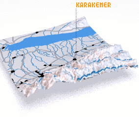
Karakemer (Almatinskaya Oblastʼ, Kazakhstan)Karakemer is a town in the Almatinskaya Oblastʼ region of Kazakhstan. An overview map of the region around Karakemer is displayed below.
regional and 3d topo map of Karakemer, Kazakhstan ::

Karakemer airports ::
The nearest airport is ALA - Alma-ata Almaty, located 47.9 km west of Karakemer.
Nearby towns ::
 Places with similar names to Karakemer, Kazakhstan ::
// Krčmari (BA)
// Krčmari (BA)
// Cracu Mare (RO)
// Creekmore (US)
// Kara-Kemer (KZ)
// Karakemer (KZ)
// Karakemer (KZ)
// Karakemer (KZ)
// Karakemir (KZ)
// Gurukumbura (LK)
Disclaimer :: Information on this page comes without warranty of any kind |
||
|
Where is Karakemer? Elevation and coordinates ::
Latitude (lat): 43°25'34"N Longitude (lon): 77°37'23"E
Elevation (approx.): 904m (map arrows pan, magnifying glasses zoom) |
||
|
Visiting Karakemer? Hotel/Accommodation ::
Book a hotel in Karakemer Travel Guide ::
Buy a travel guide for Kazakhstan rental cars ::
car rental offers GPS waypoint ::
download a GPX waypoint (PoI) of Karakemer for your GPS receiver
|
||