|
search place name
|
||
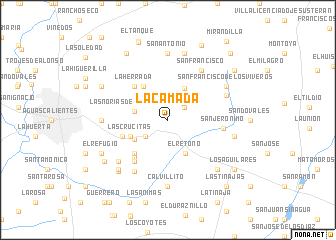
La Camada (Aguascalientes, Mexico)La Camada is a town in the Aguascalientes region of Mexico. An overview map of the region around La Camada is displayed below.
regional and 3d topo map of La Camada, Mexico ::
La Camada airports ::
The nearest airport is AGU - Aguascalientes Jesus Teran Intl, located 24.1 km south west of La Camada.
Other airports nearby include BJX - Del Bajio Guanajuato Intl (122.5 km south east), ZCL - Zacatecas General Leobardo C Ruiz Intl (123.7 km north west), SLP - San Luis Potosi Ponciano Arriaga Intl (135.6 km east), GDL - Guadalajara Don Miguel Hidalgo Y Costilla Intl (190.9 km south west), Nearby towns ::
El Socorro (2.2km north east) //
El Trigo (2.4km north east) //
Noria de Paso Hondo (2.9km south west) //
Las Norias de Ojo Caliente (3.6km west) //
La Colorada (3.9km north east) //
El Retoño (4.1km south east) //
Asturias (4.1km south west) //
Las Crucitas (4.3km south west) //
Conejal (4.5km north west) //
Santoyo (5.1km south west) //
Paso Hondo (5.1km south west) //
La Herrada (5.1km north west) //
Ojo de Agua de las Palmitas (5.1km west) //
El Dominado (5.4km south west) //
Loma Blanca (5.8km south west) //
San Jerónimo (5.8km east) //
San Francisco (6.5km north east) //
Las Mercedes (6.7km south west) //
Tierra Dura (6.6km north east) //
Malacate (6.9km south west) //
Calvillito (7.4km south) //
San Antonio (7.4km north) //
Salto de Ojo Caliente (6.9km west) //
San Francisco de los Viveros (7.1km north east) //
El Territorio (7.1km east) //
La Ordeña (7.6km north) //
El Infierno (7.6km south west) //
Cuatro Milpas (7.6km south east) //
Cobos (7.7km south west) //
[all distances 'as the bird flies' and approximate]  Places with similar names to La Camada, Mexico ::
// Lacmit (PH)
// Lacmit (PH)
// La Quemada (CU)
// Lake Meade (US)
// Lākāmta (BD)
// Ligomdé (BF)
// La Comoda (CO)
// Lukamata (CD)
// Lukomete (CD)
// Lakmade (TP)
Disclaimer :: Information on this page comes without warranty of any kind |
||
|
Where is La Camada? Elevation and coordinates ::
Latitude (lat): 21°53'0"N Longitude (lon): 102°11'0"W
Elevation (approx.): 2022m (map arrows pan, magnifying glasses zoom) |
||
|
Visiting La Camada? Hotel/Accommodation ::
Book a hotel in La Camada Travel Guide ::
Buy a travel guide for Mexico rental cars ::
car rental offers GPS waypoint ::
download a GPX waypoint (PoI) of La Camada for your GPS receiver
|
||