|
search place name
|
||
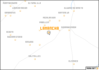
La Mancha (Zacatecas, Mexico)La Mancha is a town in the Zacatecas region of Mexico. An overview map of the region around La Mancha is displayed below.
regional and 3d topo map of La Mancha, Mexico ::
La Mancha airports ::
The nearest airport is ZCL - Zacatecas General Leobardo C Ruiz Intl, located 119.6 km south west of La Mancha.
Other airports nearby include SLP - San Luis Potosi Ponciano Arriaga Intl (173.7 km south east), AGU - Aguascalientes Jesus Teran Intl (216.4 km south), SLW - Saltillo Plan De Guadalupe Intl (233.3 km north), TRC - Torreon Intl (272.3 km north west), Nearby towns ::
La Reforma (3.9km north east) //
Pabellón (4.1km north west) //
Dolores (3.9km north west) //
Rucio Segundo (5.0km south west) //
Poza La Rusia (5.6km north) //
El Tenelo (6.5km north east) //
Sierra Hermosa (7.0km east) //
Benito Juárez (7.0km east) //
San José (7.7km south west) //
Sarteneja (9.0km north east) //
[all distances 'as the bird flies' and approximate] 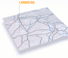 Places with similar names to La Mancha, Mexico ::
// La Mancha (US)
// Lombong Ha Chu (MY)
// Lemnushë (AL)
// La Mancha (CO)
// La Mancha (EC)
// Loma Ancha (MX)
// Loma Ancha (MX)
// Loma Ancha (HN)
// La Mancha (PE)
// Luimneach (IE)
Disclaimer :: Information on this page comes without warranty of any kind |
||
|
Where is La Mancha? Elevation and coordinates ::
Latitude (lat): 23°36'0"N Longitude (lon): 101°48'0"W
Elevation (approx.): 2093m (map arrows pan, magnifying glasses zoom) |
||
|
Visiting La Mancha? Hotel/Accommodation ::
Book a hotel in La Mancha Travel Guide ::
Buy a travel guide for Mexico rental cars ::
car rental offers GPS waypoint ::
download a GPX waypoint (PoI) of La Mancha for your GPS receiver
|
||