|
search place name
|
||
La Picota (Durango, Mexico)La Picota is a town in the Durango region of Mexico. An overview map of the region around La Picota is displayed below.
regional and 3d topo map of La Picota, Mexico ::

La Picota airports ::
The nearest airport is DGO - Durango Intl, located 5.0 km north east of La Picota.
Other airports nearby include TRC - Torreon Intl (200.8 km north east), MZT - Mazatlan General Rafael Buelna Intl (202.7 km south west), ZCL - Zacatecas General Leobardo C Ruiz Intl (231.2 km south east), Nearby towns ::
Tepetate (3.7km south) //
Francisco Montes de Oca (3.7km south) //
La Calera (3.9km north west) //
Contreras (5.6km south) //
Alcalde (5.4km east) //
San Lorenzo del Aire (5.4km east) //
Palmas (6.3km south west) //
Santa Cecilia (6.5km north west) //
Francisco Villa Nuevo (7.7km south east) //
Labor de Guadaloupe (8.1km north west) //
Cristóbal Colón (9.0km south west) //
Málaga (9.0km north east) //
Tayafe (8.8km south west) //
Benito Juarez (10.0km south west) //
[all distances 'as the bird flies' and approximate] 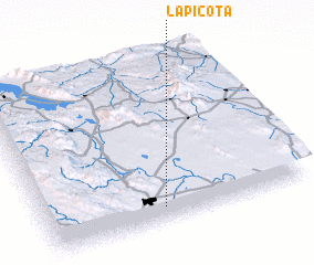 Places with similar names to La Picota, Mexico ::
// La Paquita (PA)
// La Piqueta (ES)
// La Picota (CO)
// La Picota (MX)
// La Picota (HN)
// La Paquita (AR)
// La Picada (AR)
// Le Pégut (FR)
// Le Pequet (BE)
// Le Piquet (BE)
Disclaimer :: Information on this page comes without warranty of any kind |
||
|
Where is La Picota? Elevation and coordinates ::
Latitude (lat): 24°5'0"N Longitude (lon): 104°33'0"W
Elevation (approx.): 1857m (map arrows pan, magnifying glasses zoom) |
||
|
Visiting La Picota? Hotel/Accommodation ::
Book a hotel in La Picota Travel Guide ::
Buy a travel guide for Mexico rental cars ::
car rental offers GPS waypoint ::
download a GPX waypoint (PoI) of La Picota for your GPS receiver
|
||