|
search place name
|
||
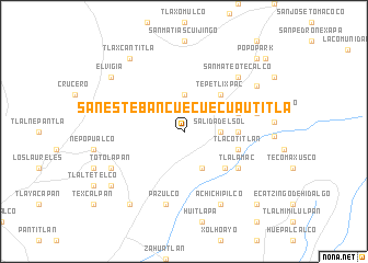
San Esteban Cuecuecuautitla (México, Mexico)San Esteban Cuecuecuautitla is a town in the México region of Mexico. An overview map of the region around San Esteban Cuecuecuautitla is displayed below.
regional and 3d topo map of San Esteban Cuecuecuautitla, Mexico ::
San Esteban Cuecuecuautitla airports ::
The nearest airport is CVJ - Cuernavaca General Mariano Matamoros, located 47.0 km south west of San Esteban Cuecuecuautitla.
Other airports nearby include PBC - Puebla Hermanos Serdan Intl (53.3 km east), MEX - Mexico City Licenciado Benito Juarez Intl (53.6 km north west), TLC - Toluca Licenciado Adolfo Lopez Mateos Intl (84.0 km north west), TXA - Tlaxcala (92.8 km north east), Nearby towns ::
Salida del Sol (3.5km east) //
Atlapango (3.7km north) //
Nepantla de Sor Juana Inés de la Cruz (4.1km south east) //
Tepetlixpac (5.1km north east) //
Santiago Mamalhuazuca (5.3km east) //
Guadalupe Hidalgo (5.4km south east) //
Tlacotitlán (5.6km east) //
San Vicente Chimalhuacán Chalco (5.6km east) //
Tlalamac (6.4km south east) //
Atlautla (7.2km east) //
Pazulco (7.6km south) //
Ozumba de Alzate (7.7km north east) //
San Mateo Tecalco (7.7km north east) //
Achichipilco (8.2km south east) //
Totolapan (7.9km south west) //
San Antonio Alzate (8.4km north east) //
Coatepec (8.9km north west) //
El Vigía (8.9km north west) //
Tepetlixpita (8.9km south west) //
Tlaxcantitla (9.1km north west) //
Atlatlahucan (9.1km south west) //
San Juan Tlacotompa (10.2km south east) //
Huecahuasco (10.2km south east) //
Popo Park (10.2km north east) //
Las Delícias (10.8km north east) //
[all distances 'as the bird flies' and approximate]  Places with similar names to San Esteban Cuecuecuautitla, Mexico :: Disclaimer :: Information on this page comes without warranty of any kind |
||
|
Where is San Esteban Cuecuecuautitla? Elevation and coordinates ::
Latitude (lat): 19°0'0"N Longitude (lon): 98°51'0"W
Elevation (approx.): 2168m (map arrows pan, magnifying glasses zoom) |
||
|
Visiting San Esteban Cuecuecuautitla? Hotel/Accommodation ::
Book a hotel in San Esteban Cuecuecuautitla Travel Guide ::
Buy a travel guide for Mexico rental cars ::
car rental offers GPS waypoint ::
download a GPX waypoint (PoI) of San Esteban Cuecuecuautitla for your GPS receiver
|
||