|
search place name
|
||
Santa Isabel (Tlaxcala, Mexico)Santa Isabel is a town in the Tlaxcala region of Mexico. An overview map of the region around Santa Isabel is displayed below.
regional and 3d topo map of Santa Isabel, Mexico ::

Santa Isabel airports ::
The nearest airport is PBC - Puebla Hermanos Serdan Intl, located 11.2 km south west of Santa Isabel.
Other airports nearby include TXA - Tlaxcala (36.9 km north), MEX - Mexico City Licenciado Benito Juarez Intl (85.5 km west), PCA - Pachuca Ingeniero Juan Guillermo Villasana (107.7 km north west), CVJ - Cuernavaca General Mariano Matamoros (110.9 km south west), Nearby towns ::
Tetlatlahuaca (1.1km north) //
La Concordia (1.5km north west) //
Santa Cruz Aquiahuac (2.1km north east) //
Los Reyes (2.1km south east) //
Teacalco (2.5km north west) //
Santa Ana Portales (2.7km south) //
San Bartolomé Tenango (2.7km north) //
Tenango (2.9km north) //
Santa Apolonia Teacalco (3.1km north) //
Nativitas (3.0km west) //
Santeagueda (3.6km south) //
Guadalupe Victoria (3.7km west) //
Aquiahuac Tlachco (3.8km north east) //
Zacualpan (3.9km north east) //
Huactzingo (4.2km east) //
Capula (4.3km west) //
San Miguel Xoxtla (4.6km south) //
Segura (4.5km west) //
Santiago Michac (4.6km west) //
Coamilpa (4.9km north) //
San Miguel del Milagro (4.9km west) //
Los Pinos (5.2km south west) //
Santa Clara (5.5km south west) //
Zacatelco (5.5km east) //
Texoloc (5.9km north) //
Xacaltzingo (6.1km east) //
Santa Elena (6.3km west) //
Metepec (6.6km north east) //
Tepeyanco (6.5km east) //
[all distances 'as the bird flies' and approximate] 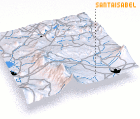 Places with similar names to Santa Isabel, Mexico ::
// Santa Isabel (BR)
// Santa Isabel (BR)
// Santa Isabel (BR)
// Santa Isabel (BR)
// Santa Isabel (BR)
// Santa Isabel (BR)
// Santa Isabel (BR)
// Santa Isabel (BR)
// Santa Isabel (BR)
// Santa Isabel (BR)
Disclaimer :: Information on this page comes without warranty of any kind |
||
|
Where is Santa Isabel? Elevation and coordinates ::
Latitude (lat): 19°13'25"N Longitude (lon): 98°17'25"W
Elevation (approx.): 2192m (map arrows pan, magnifying glasses zoom) |
||
|
Visiting Santa Isabel? Hotel/Accommodation ::
Book a hotel in Santa Isabel Travel Guide ::
Buy a travel guide for Mexico rental cars ::
car rental offers GPS waypoint ::
download a GPX waypoint (PoI) of Santa Isabel for your GPS receiver
|
||