|
search place name
|
||
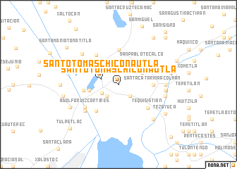
Santo Tomás Chiconautla (México, Mexico)Santo Tomás Chiconautla is a town in the México region of Mexico. An overview map of the region around Santo Tomás Chiconautla is displayed below.
regional and 3d topo map of Santo Tomás Chiconautla, Mexico ::
Santo Tomás Chiconautla airports ::
The nearest airport is MEX - Mexico City Licenciado Benito Juarez Intl, located 23.7 km south west of Santo Tomás Chiconautla.
Other airports nearby include PCA - Pachuca Ingeniero Juan Guillermo Villasana (53.4 km north east), TLC - Toluca Licenciado Adolfo Lopez Mateos Intl (69.4 km south west), PBC - Puebla Hermanos Serdan Intl (83.1 km south east), TXA - Tlaxcala (85.6 km east), Nearby towns ::
Totelcingo (2.5km south east) //
Venta de Carpio (2.5km south west) //
Santo Tomas Chiconautla (2.7km west) //
Santa María Chiconautla (2.8km south west) //
Laja (4.0km north east) //
Zumbilla (4.1km north west) //
Antonio Luis Cortines (4.5km west) //
San Pablo Tecalco (5.1km north east) //
Aquiles Serdán (5.3km south west) //
Santa Catarina Acolman (5.2km east) //
San Francisco Cuautliquixco (5.6km north) //
San Martín de Pones (5.3km west) //
San Pedro Atzompa (5.7km north west) //
Tequisistián (5.7km south east) //
Adolfo Ruiz Cortínes (6.2km south west) //
San Marcos Nepantla (6.4km north east) //
San Martín de Porres (6.5km south west) //
Acolman de Netzahualcóyotl (7.0km east) //
Acolman (7.0km east) //
Hacienda Ojo de Agua (7.3km north west) //
Tepexnan (7.2km east) //
Cuanalan (7.2km east) //
Nexquipayac (7.6km south east) //
Santa Isabel Ixtapan (7.6km south east) //
Ecatepec (8.1km south west) //
Santa María Acolman (8.1km east) //
Tezoyuca (8.4km south east) //
San Bartolo (8.3km east) //
Guadalupe Victoria (8.5km west) //
[all distances 'as the bird flies' and approximate] 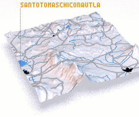 Places with similar names to Santo Tomás Chiconautla, Mexico ::
// Santo Tomas Chiconautla (MX)
Disclaimer :: Information on this page comes without warranty of any kind |
||
|
Where is Santo Tomás Chiconautla? Elevation and coordinates ::
Latitude (lat): 19°38'0"N Longitude (lon): 98°59'0"W
Elevation (approx.): 2320m (map arrows pan, magnifying glasses zoom) |
||
|
Visiting Santo Tomás Chiconautla? Hotel/Accommodation ::
Book a hotel in Santo Tomás Chiconautla Travel Guide ::
Buy a travel guide for Mexico rental cars ::
car rental offers GPS waypoint ::
download a GPX waypoint (PoI) of Santo Tomás Chiconautla for your GPS receiver
|
||