|
search place name
|
||
Al Ḩarīqah (Mont-Liban, Lebanon)Al Ḩarīqah is a town in the Mont-Liban region of Lebanon. An overview map of the region around Al Ḩarīqah is displayed below.
regional and 3d topo map of Al Ḩarīqah, Lebanon ::

Al Ḩarīqah airports ::
The nearest airport is BEY - Beirut Rafic Hariri Intl, located 40.9 km south west of Al Ḩarīqah.
Other airports nearby include DAM - Damascus Intl (99.7 km south east), RPN - Rosh Pina Mahanaim I Ben Yaakov (124.1 km south), LTK - Latakia Bassel Al Assad Intl (146.8 km north), HFA - Haifa (157.8 km south west), Nearby towns ::
Aḑ Ḑay‘ah (1.9km south) //
Al Khallah (1.9km south) //
Raʼs al Karm (1.9km south) //
Qamaz (1.9km south) //
Qirqrayyā al Fawqā (1.9km south) //
Frāt (1.5km west) //
Tārū‘ al Qaţţīn (1.5km west) //
Bulḩuş (1.9km north) //
Al ‘Abrah (2.4km south west) //
Qirqrayyā (2.4km south east) //
Ksār al Mashraqah (2.4km north west) //
Ḩayy al Fawqā (2.4km north west) //
‘Ayn Jurayn (3.1km west) //
‘Ayn ad Dulbah (3.1km west) //
Al Mashnaqah (3.1km west) //
Jannah (3.1km east) //
Waţāʼ al Ḩarājilīyah (3.7km south) //
‘Ayn al Qadaḩ (3.7km south) //
Ḩaqlat al Ḩayā (3.7km north) //
Bkartā (3.7km north) //
Shwān (3.6km south west) //
Ksār ash Shidyāq (3.6km south west) //
Ḩuqūl al Mahdī (3.6km south east) //
Waţāʼ al Khirbah (3.6km south east) //
Al Ḩarīq (3.6km north west) //
Firḩit (3.6km north west) //
Aş Şawwānah (3.6km north west) //
Al Fatḩān (3.6km north west) //
Ḩuşnā (3.6km north west) //
[all distances 'as the bird flies' and approximate] 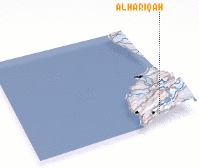 Places with similar names to Al Ḩarīqah, Lebanon ::
// Al Ḩarīq (SA)
// Al Ḩurayyiq (SA)
// Al Ḩarīqah (SD)
// Al Ḩarāk (SY)
// Al Ḩarākī (SY)
// Al Ḩarāʼik (SY)
// Al Ḩarāʼiq (LB)
// Al Ḩarīqah (LB)
// Al Ḩarīq (LB)
// Al Ḩarīq (LB)
Disclaimer :: Information on this page comes without warranty of any kind |
||
|
Where is Al Ḩarīqah? Elevation and coordinates ::
Latitude (lat): 34°5'0"N Longitude (lon): 35°48'0"E
Elevation (approx.): 814m (map arrows pan, magnifying glasses zoom) |
||
|
Visiting Al Ḩarīqah? Hotel/Accommodation ::
Book a hotel in Al Ḩarīqah Travel Guide ::
Buy a travel guide for Lebanon rental cars ::
car rental offers GPS waypoint ::
download a GPX waypoint (PoI) of Al Ḩarīqah for your GPS receiver
|
||